Approximate Location Map
Large Map »
Latitude: 50.1958 / 50°11'44"N
Longitude: -5.4814 / 5°28'52"W
OS Eastings: 151630
OS Northings: 38668
OS Grid: SW516386
Mapcode National: GBR DXV5.807
Mapcode Global: VH12L.YB2Q
Plus Code: 9C2P5GW9+8C
Entry Name: Knill's Monument, Worvas
Listing Date: 4 June 1952
Grade: II*
Source: Historic England
Source ID: 1143386
English Heritage Legacy ID: 68916
Also known as: The Steeple
ID on this website: 101143386
Location: Halsetown, Cornwall, TR26
County: Cornwall
Civil Parish: St. Ives
Traditional County: Cornwall
Lieutenancy Area (Ceremonial County): Cornwall
Church of England Parish: Carbis Bay
Church of England Diocese: Truro
Tagged with: Monument
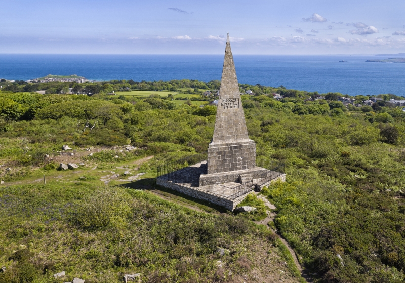
Knill's Monument,
1. Worvas
1587
SW 53 NW 5/14 4.6.52
II
2.
1782. A tall granite pyramid, originally intended as a mausoleum for his
remains by John knill, one time Mayor of St Ives. Now serves as a landmark
and a centre of a memorial ceremony held every five years. ~
Listing NGR: SW5163038668
External links are from the relevant listing authority and, where applicable, Wikidata. Wikidata IDs may be related buildings as well as this specific building. If you want to add or update a link, you will need to do so by editing the Wikidata entry.


Other nearby listed buildings
