Approximate Location Map
Large Map »
Latitude: 50.2133 / 50°12'47"N
Longitude: -5.4804 / 5°28'49"W
OS Eastings: 151793
OS Northings: 40611
OS Grid: SW517406
Mapcode National: GBR DXV3.VW8
Mapcode Global: VH12D.YWLV
Plus Code: 9C2P6G79+8V
Entry Name: The Union Inn
Listing Date: 22 December 1972
Grade: II
Source: Historic England
Source ID: 1143378
English Heritage Legacy ID: 68992
ID on this website: 101143378
Location: St Ives, Cornwall, TR26
County: Cornwall
Civil Parish: St. Ives
Built-Up Area: St Ives
Traditional County: Cornwall
Lieutenancy Area (Ceremonial County): Cornwall
Church of England Parish: St Ives
Church of England Diocese: Truro
Tagged with: Inn
FORE STREET
1. (West Side)
1587 -----------
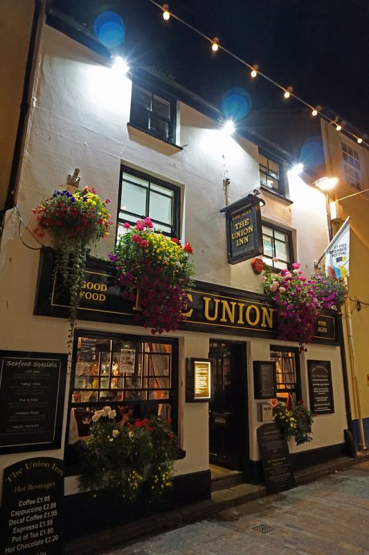
The Union Inn
SW 54 SW 1/71
II GV
2.
Mid C19. Stucco. Three storey. Two windows, sashes, no glazing bars.
Central door, panelled. Slate roof. Group value.
The Union Inn and No 22 form a group.
Listing NGR: SW5179340611
External links are from the relevant listing authority and, where applicable, Wikidata. Wikidata IDs may be related buildings as well as this specific building. If you want to add or update a link, you will need to do so by editing the Wikidata entry.


Other nearby listed buildings
