Approximate Location Map
Large Map »
Latitude: 50.2144 / 50°12'51"N
Longitude: -5.4804 / 5°28'49"W
OS Eastings: 151793
OS Northings: 40729
OS Grid: SW517407
Mapcode National: GBR DXV3.NFX
Mapcode Global: VH12D.YWK0
Plus Code: 9C2P6G79+QR
Entry Name: 48, Fore Street
Listing Date: 22 December 1972
Grade: II
Source: Historic England
Source ID: 1143381
English Heritage Legacy ID: 69000
ID on this website: 101143381
Location: St Ives, Cornwall, TR26
County: Cornwall
Civil Parish: St. Ives
Built-Up Area: St Ives
Traditional County: Cornwall
Lieutenancy Area (Ceremonial County): Cornwall
Church of England Parish: St Ives
Church of England Diocese: Truro
Tagged with: Building
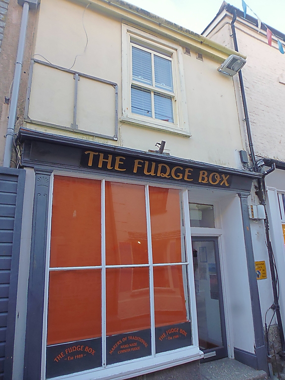
FORE STREET
1. (West Side)
1587 -----------
No 48
SW 54 SW 1/80
II GV
2.
Early C19, Stucco, Two storey, one window, sash in moulder case with
glazing bars. Victorian shop, flat pilasters, small cornice. Slate roof.
Group value.
Nos 42 to 52 (even) form a group.
Listing NGR: SW5179340729
External links are from the relevant listing authority and, where applicable, Wikidata. Wikidata IDs may be related buildings as well as this specific building. If you want to add or update a link, you will need to do so by editing the Wikidata entry.


Other nearby listed buildings
