Approximate Location Map
Large Map »
Latitude: 50.2144 / 50°12'51"N
Longitude: -5.4804 / 5°28'49"W
OS Eastings: 151797
OS Northings: 40734
OS Grid: SW517407
Mapcode National: GBR DXV3.NH0
Mapcode Global: VH12D.YVLZ
Plus Code: 9C2P6G79+QR
Entry Name: 50, Fore Street
Listing Date: 22 December 1972
Grade: II
Source: Historic England
Source ID: 1327763
English Heritage Legacy ID: 69001
ID on this website: 101327763
Location: St Ives, Cornwall, TR26
County: Cornwall
Civil Parish: St. Ives
Built-Up Area: St Ives
Traditional County: Cornwall
Lieutenancy Area (Ceremonial County): Cornwall
Church of England Parish: St Ives
Church of England Diocese: Truro
Tagged with: Building
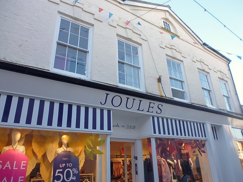
FORE STREET
1. (West Side)
1587 -----------
No 50
SW 54 SW 1/81
II GV
2.
C18. Painted brickwork. Slate hipped roof. Central pedinent with small
semi-circular window. Plain brick eaves course. Two storeys and attic.
Five windows, double hung sashes with glazing bars, keystones, brick label
moulds. Large C20 incongruous shop front over whole of ground floor front.
Nos 42 to 52 (even) form a group.
Listing NGR: SW5179740734
External links are from the relevant listing authority and, where applicable, Wikidata. Wikidata IDs may be related buildings as well as this specific building. If you want to add or update a link, you will need to do so by editing the Wikidata entry.


Other nearby listed buildings
