Latitude: 50.1527 / 50°9'9"N
Longitude: -5.5698 / 5°34'11"W
OS Eastings: 145088
OS Northings: 34177
OS Grid: SW450341
Mapcode National: GBR DXM8.PJC
Mapcode Global: VH059.DFS8
Plus Code: 9C2P5C3J+33
Entry Name: Guide Post at SW 451341
Listing Date: 7 September 1988
Grade: II
Source: Historic England
Source ID: 1143571
English Heritage Legacy ID: 70428
ID on this website: 101143571
Location: Lower Ninnes, Cornwall, TR20
County: Cornwall
Civil Parish: Madron
Traditional County: Cornwall
Lieutenancy Area (Ceremonial County): Cornwall
Church of England Parish: Gulval
Church of England Diocese: Truro
Tagged with: Fingerpost
MADRON
SW 43 SE
7/175 Guide post at SW 451341
- II
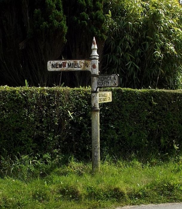
Guide post. Circa early C20. Painted iron guide post with 3 adjustable pointers
letters and numerals in relief. Arrowhead finial. Complete.
Inscriptions: NEW MILL ½
TREDINNECK ¾ BODRIFTY ¾
TRYTHALL ½ PENZANCE 3¼
Listing NGR: SW4508834177
External links are from the relevant listing authority and, where applicable, Wikidata. Wikidata IDs may be related buildings as well as this specific building. If you want to add or update a link, you will need to do so by editing the Wikidata entry.


Other nearby listed buildings