Approximate Location Map
Large Map »
Latitude: 50.1518 / 50°9'6"N
Longitude: -5.5604 / 5°33'37"W
OS Eastings: 145758
OS Northings: 34038
OS Grid: SW457340
Mapcode National: GBR DXN8.V47
Mapcode Global: VH059.KGS0
Plus Code: 9C2P5C2Q+PR
Entry Name: Newmill Bridge
Listing Date: 7 September 1988
Grade: II
Source: Historic England
Source ID: 1137199
English Heritage Legacy ID: 70516
ID on this website: 101137199
Location: Lower Ninnes, Cornwall, TR20
County: Cornwall
Civil Parish: Madron
Traditional County: Cornwall
Lieutenancy Area (Ceremonial County): Cornwall
Church of England Parish: Gulval
Church of England Diocese: Truro
Tagged with: Bridge
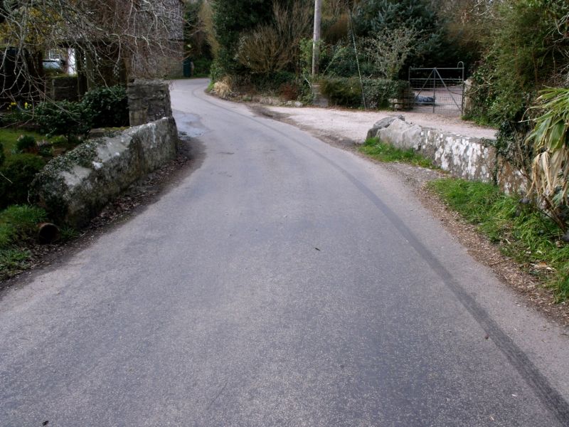
MADRON NEW MILL
SW 43 SE
7/170 Newmill Bridge
-
GV II
Bridge with adjoining well. Probably C18. Dressed granite and rubble moorstone.
Single-span bridge crossing the Trevaylor stream obliquely. Granite lintels and low
parapet. On the north east side a spring is fed through a man made sump to allow
buckets to be filled.
Listing NGR: SW4575834038
External links are from the relevant listing authority and, where applicable, Wikidata. Wikidata IDs may be related buildings as well as this specific building. If you want to add or update a link, you will need to do so by editing the Wikidata entry.


Other nearby listed buildings
