Approximate Location Map
Large Map »
Latitude: 50.1023 / 50°6'8"N
Longitude: -5.6247 / 5°37'28"W
OS Eastings: 140899
OS Northings: 28766
OS Grid: SW408287
Mapcode National: GBR DXHD.VRT
Mapcode Global: VH05G.GP9D
Plus Code: 9C2P492G+W4
Entry Name: Cross at SW408287
Listing Date: 15 December 1988
Grade: II
Source: Historic England
Source ID: 1143854
English Heritage Legacy ID: 69809
ID on this website: 101143854
Location: Brane, Cornwall, TR20
County: Cornwall
Civil Parish: Sancreed
Traditional County: Cornwall
Lieutenancy Area (Ceremonial County): Cornwall
Church of England Parish: Sancreed
Church of England Diocese: Truro
Tagged with: Monumental cross
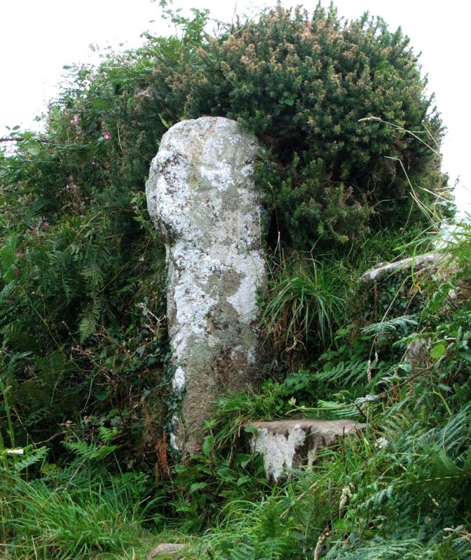
SANCREED
SW 42 NW
Brane or Boswarthen
5/268 Cross at SW408287
-
II
Cross. Pre-Conquest. Dressed granite wheel-headed monolith with Latin cross to each side. Incised cross to most visible side, cross in relief to partly hidden side.
Scheduled Ancient Monument 264.
Listing NGR: SW4089928766
External links are from the relevant listing authority and, where applicable, Wikidata. Wikidata IDs may be related buildings as well as this specific building. If you want to add or update a link, you will need to do so by editing the Wikidata entry.


Other nearby listed buildings
