Approximate Location Map
Large Map »
Latitude: 50.3334 / 50°20'0"N
Longitude: -4.7585 / 4°45'30"W
OS Eastings: 203778
OS Northings: 51807
OS Grid: SX037518
Mapcode National: GBR N1.X7JD
Mapcode Global: FRA 08X5.3YN
Plus Code: 9C2Q86MR+9H
Entry Name: Wesleyan Chapel and Attached Schoolrooms
Listing Date: 11 March 1974
Last Amended: 22 March 1999
Grade: II*
Source: Historic England
Source ID: 1144292
English Heritage Legacy ID: 70686
ID on this website: 101144292
Location: Charlestown, Cornwall, PL25
County: Cornwall
Civil Parish: St Austell Bay
Built-Up Area: St Austell
Traditional County: Cornwall
Lieutenancy Area (Ceremonial County): Cornwall
Church of England Parish: Charlestown
Church of England Diocese: Truro
Tagged with: Chapel
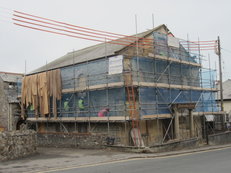
CHARLESTOWN
1. CHARLESTOWN ROAD
1584A (East Side)
Wesleyan Chapel
SX 0351 NE 4/30
II
2.
Date stone 1827. Ashlar faced, 2 storeys. 3 windows with semi-circular
heads on pedimented gable end. Open Doric entrance porch. Date stone
with pilasters and cornice.
Listing NGR: SX0377851807
External links are from the relevant listing authority and, where applicable, Wikidata. Wikidata IDs may be related buildings as well as this specific building. If you want to add or update a link, you will need to do so by editing the Wikidata entry.


Other nearby listed buildings
