Latitude: 50.3333 / 50°19'59"N
Longitude: -4.759 / 4°45'32"W
OS Eastings: 203743
OS Northings: 51790
OS Grid: SX037517
Mapcode National: GBR N1.X7D1
Mapcode Global: FRA 08X5.3S7
Plus Code: 9C2Q86MR+89
Entry Name: 69, Charlestown Road
Listing Date: 11 March 1974
Grade: II
Source: Historic England
Source ID: 1327291
English Heritage Legacy ID: 70678
ID on this website: 101327291
Location: Charlestown, Cornwall, PL25
County: Cornwall
Civil Parish: St Austell Bay
Built-Up Area: St Austell
Traditional County: Cornwall
Lieutenancy Area (Ceremonial County): Cornwall
Church of England Parish: Charlestown
Church of England Diocese: Truro
Tagged with: Building
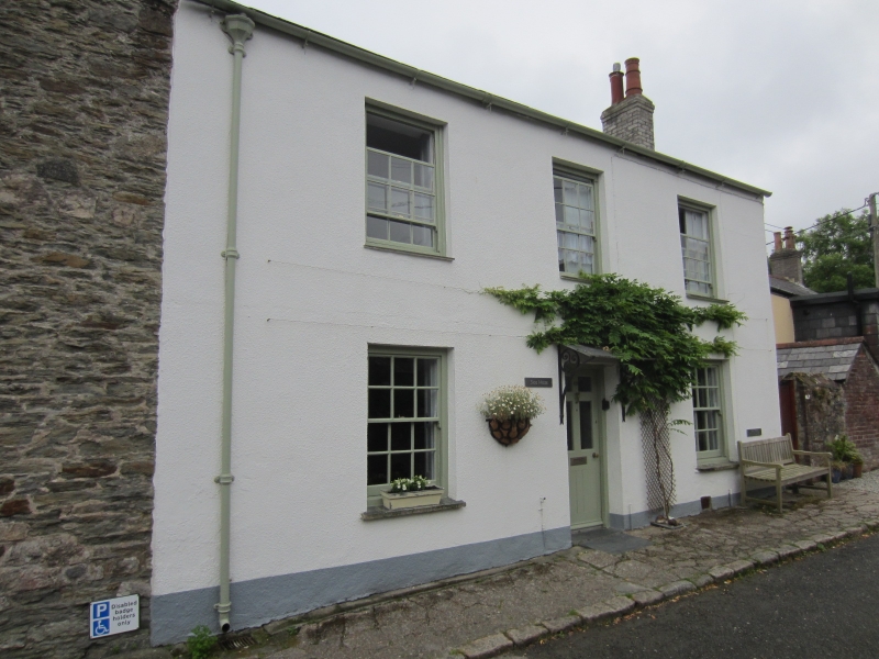
CHARLESTOWN
1. CHARLESTOWN ROAD
1584A (West Side)
No 69
SX 0351 NE 4/17
II GV
2.
Earlier C19 cottage. Cement rendered nibble. 2 storeys. 3 windows
sashes with glazing bars. Central door panelled and glazed. Slate roof.
Adjoining and at rear of No 67. Included for group value only.
Nos 67 to 85 (odd) form a group.
Listing NGR: SX0374351790
External links are from the relevant listing authority and, where applicable, Wikidata. Wikidata IDs may be related buildings as well as this specific building. If you want to add or update a link, you will need to do so by editing the Wikidata entry.


Other nearby listed buildings