Approximate Location Map
Large Map »
Latitude: 50.1921 / 50°11'31"N
Longitude: -5.5676 / 5°34'3"W
OS Eastings: 145460
OS Northings: 38540
OS Grid: SW454385
Mapcode National: GBR DXM5.JKB
Mapcode Global: VH053.GF0M
Plus Code: 9C2P5CRJ+RX
Entry Name: Stile at SW 4043853
Listing Date: 7 September 1988
Grade: II
Source: Historic England
Source ID: 1144320
English Heritage Legacy ID: 70647
ID on this website: 101144320
Location: Zennor, Cornwall, TR26
County: Cornwall
Civil Parish: Zennor
Traditional County: Cornwall
Lieutenancy Area (Ceremonial County): Cornwall
Church of England Parish: Zennor
Church of England Diocese: Truro
Tagged with: Stile
ZENNOR ZENNOR
SW 43 NE
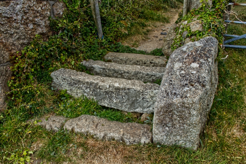
4/328 Stile at SW 4043853
-
GV II
Stile. Circa early C19. Granite rubble and dressed granite. Grid stile with low
wall of rubble monoliths on 1 side and former school wall qv on the other.
Listing NGR: SW4545738540
External links are from the relevant listing authority and, where applicable, Wikidata. Wikidata IDs may be related buildings as well as this specific building. If you want to add or update a link, you will need to do so by editing the Wikidata entry.


Other nearby listed buildings
