Latitude: 50.1917 / 50°11'30"N
Longitude: -5.5677 / 5°34'3"W
OS Eastings: 145451
OS Northings: 38506
OS Grid: SW454385
Mapcode National: GBR DXM5.JJD
Mapcode Global: VH053.FFYV
Plus Code: 9C2P5CRJ+MW
Entry Name: House Adjoining North East of the Tinners Arms
Listing Date: 7 September 1988
Grade: II
Source: Historic England
Source ID: 1327287
English Heritage Legacy ID: 70658
ID on this website: 101327287
Location: Zennor, Cornwall, TR26
County: Cornwall
Civil Parish: Zennor
Traditional County: Cornwall
Lieutenancy Area (Ceremonial County): Cornwall
Church of England Parish: Zennor
Church of England Diocese: Truro
Tagged with: House
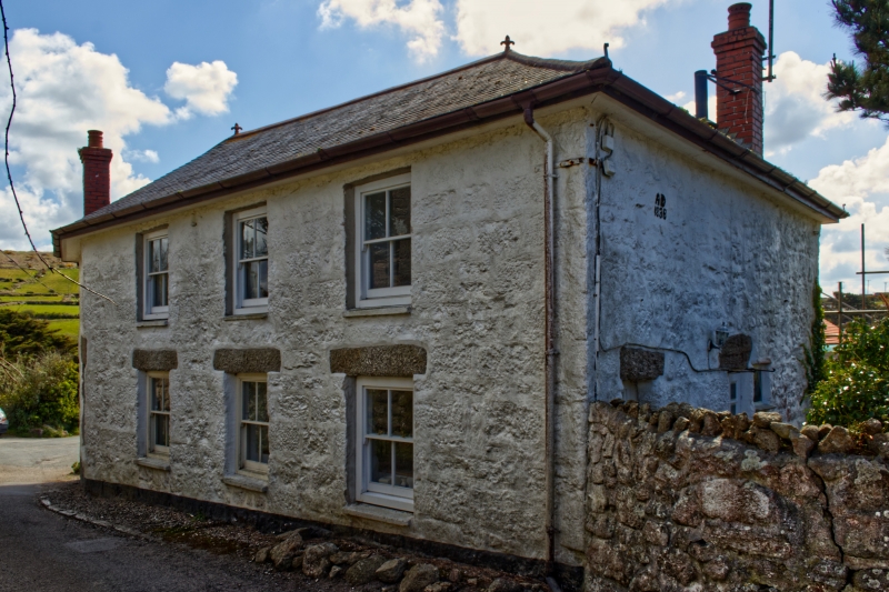
ZENNOR ZENNOR SW 43 NE 4/346 House adjoining north east of The - Tinners Arms GV II House. Datestone 1838, extended circa mid C19. Painted granite rubble with granite dressings. Slurried scantle slate hipped roof with deep eaves and brick chimney over original right-hand (north) side wall. Plan: originally a shallow double-depth house with 2 front rooms and central lobby or cross passage. Circa mid C19 a 1-room plan bay was added at the left hand side, slightly irregularly shaped because of the site and with its windows in the left-hand end. Exterior: 2 storeys. Originally symmetrical 3 window east front with central doorway. Doorway now in left hand window opening. C19 4-panel door; circa late C19 4-pane horned sashes except circa mid C19 12-pane hornless sash to left-hand end (ground floor). Over the end window is a circa late C19 oriel bay window with hipped roof. Interior: not inspected.
Listing NGR: SW4544938508
External links are from the relevant listing authority and, where applicable, Wikidata. Wikidata IDs may be related buildings as well as this specific building. If you want to add or update a link, you will need to do so by editing the Wikidata entry.


Other nearby listed buildings