Approximate Location Map
Large Map »
Latitude: 54.7497 / 54°44'58"N
Longitude: -3.0499 / 3°2'59"W
OS Eastings: 332517
OS Northings: 539919
OS Grid: NY325399
Mapcode National: GBR 7F4J.H5
Mapcode Global: WH80M.3WX6
Plus Code: 9C6RPXX2+V2
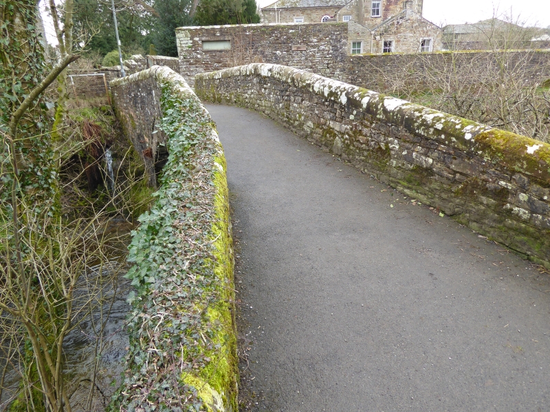
Entry Name: Church Bridge
Listing Date: 3 January 1986
Grade: II
Source: Historic England
Source ID: 1144474
English Heritage Legacy ID: 72357
ID on this website: 101144474
Location: Caldbeck, Cumberland, Cumbria, CA7
County: Cumbria
District: Allerdale
Civil Parish: Caldbeck
Built-Up Area: Caldbeck
Traditional County: Cumberland
Lieutenancy Area (Ceremonial County): Cumbria
Church of England Parish: Caldbeck St Mungo
Church of England Diocese: Carlisle
Tagged with: Bridge
NY 33 NW CALDBECK Caldbeck
13/49 Church Bridge
II
Footbridge, probably a pack-horse bridge. Probably C18 with C19 and C20
repairs. Mixed sandstone and limestone coursed rubble. Narrow slightly humped
single-span arch under solid parapet with saddleback coping.
Listing NGR: NY3251739919
External links are from the relevant listing authority and, where applicable, Wikidata. Wikidata IDs may be related buildings as well as this specific building. If you want to add or update a link, you will need to do so by editing the Wikidata entry.


Other nearby listed buildings
