Approximate Location Map
Large Map »
Latitude: 54.5214 / 54°31'16"N
Longitude: -2.3197 / 2°19'10"W
OS Eastings: 379405
OS Northings: 514055
OS Grid: NY794140
Mapcode National: GBR DJ74.LZ
Mapcode Global: WH938.BMM6
Plus Code: 9C6VGMCJ+G4
Entry Name: Maypole on Former Cross Base
Listing Date: 21 June 1984
Grade: II
Source: Historic England
Source ID: 1144912
English Heritage Legacy ID: 73310
ID on this website: 101144912
Location: Church Brough, Westmorland and Furness, Cumbria, CA17
County: Cumbria
District: Eden
Civil Parish: Brough
Built-Up Area: Brough
Traditional County: Westmorland
Lieutenancy Area (Ceremonial County): Cumbria
Church of England Parish: Brough St Michael
Church of England Diocese: Carlisle
Tagged with: Stone cross
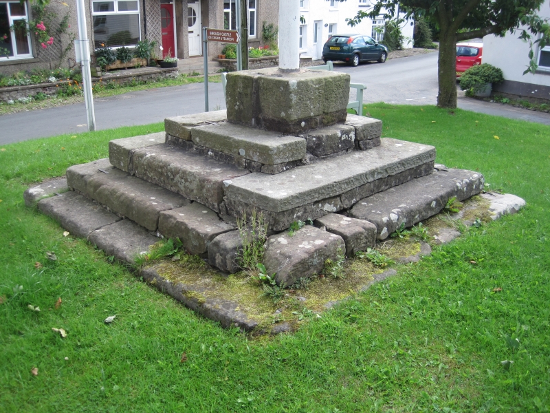
NY 7914 BROUGH THE SQUARE
CHURCH BROUGH
(East side)
16/28 Maypole on former
Cross base
G.V. II
Former cross base of uncertain date but possibly medieval; refurbished C19/C20.
5 steps of large sandstone blocks, now supports maypole.
Listing NGR: NY7940514055
External links are from the relevant listing authority and, where applicable, Wikidata. Wikidata IDs may be related buildings as well as this specific building. If you want to add or update a link, you will need to do so by editing the Wikidata entry.


Other nearby listed buildings
