Latitude: 54.3095 / 54°18'34"N
Longitude: -2.7604 / 2°45'37"W
OS Eastings: 350622
OS Northings: 490700
OS Grid: SD506907
Mapcode National: GBR 9L5L.5X
Mapcode Global: WH82W.KYQ4
Plus Code: 9C6V865Q+RR
Entry Name: Helsington Laithes Farmhouse
Listing Date: 24 April 1951
Grade: II*
Source: Historic England
Source ID: 1145728
English Heritage Legacy ID: 75342
ID on this website: 101145728
Location: Westmorland and Furness, Cumbria, LA9
County: Westmorland and Furness
District: South Lakeland
Civil Parish: Kendal
Traditional County: Westmorland
Lieutenancy Area (Ceremonial County): Cumbria
Church of England Parish: Underbarrow with Helsington
Church of England Diocese: Carlisle
Tagged with: Farmhouse
SD 59 SW (INSET) KENDAL A6 (North side)
2/1 Helsington Laithes farmhouse 24-4-51 G.V. II*
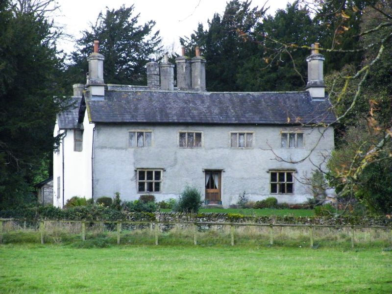
Manor House. Late C15/early C16. Partly rebuilt/extended c1690 for Colonel J. Graham. Wet-dashed rubble on plinth. Graduated slate roofs with projecting eaves. Diagonally-set rendered chimneys. Mainly 2 storeys with attics. Asymmetrical plan. Western block is oldest surviving part. Central block and eastern cross-wing added; plaster wall panel (originally on ceiling?) gives initials I. & A.B. (for James & Agnes Bellingham?) and date 1538 but details are identical to late C16 plasterwork at Levens Hall and date should probably read 1583. Symmetrical 4-bay east elevation has part-glazed central door with mullioned and transomed 3-light window, under hoodmould, to either side; four 3-light windows above. Windows throughout probably C19 (with majority of decorative leading replaced in C20) except for 2 original stone-mullioned windows to south elevation of western block: Ground floor window has 2 segment-headed lights, 1st floor window has 3 ogee-headed lights under hoodmould. Interior mainly C19 with some earlier studded plank doors and a C17 closed-string staircase with turned balusters, square newels, and moulded handrail.
Listing NGR: SD5062290700
External links are from the relevant listing authority and, where applicable, Wikidata. Wikidata IDs may be related buildings as well as this specific building. If you want to add or update a link, you will need to do so by editing the Wikidata entry.


Other nearby listed buildings