Latitude: 54.204 / 54°12'14"N
Longitude: -2.5985 / 2°35'54"W
OS Eastings: 361059
OS Northings: 478863
OS Grid: SD610788
Mapcode National: GBR BM9T.7Q
Mapcode Global: WH94P.1LXH
Plus Code: 9C6V6C32+JJ
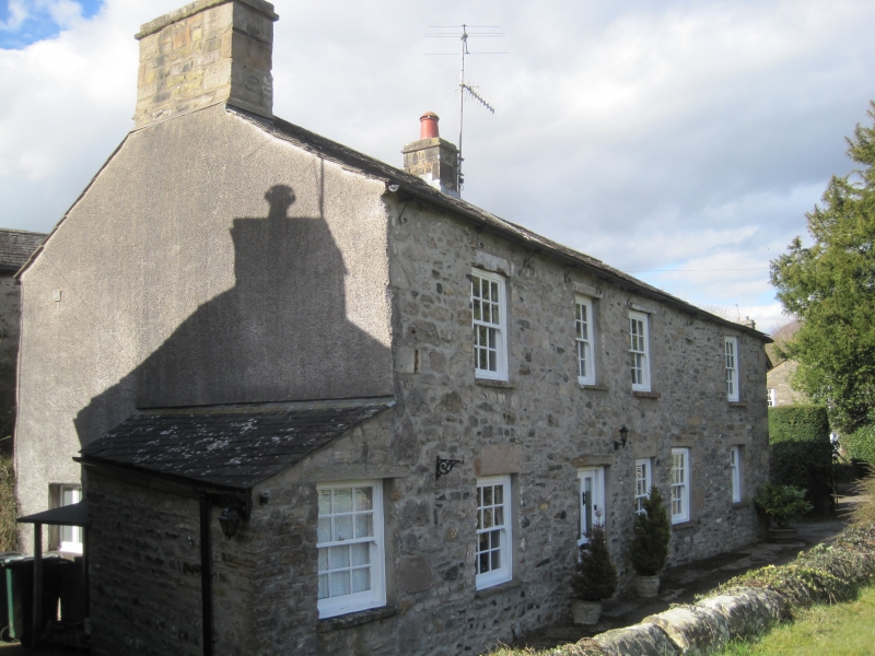
Entry Name: 2 and 8, Vicarage Lane
Listing Date: 22 March 1983
Grade: II
Source: Historic England
Source ID: 1145738
English Heritage Legacy ID: 75270
ID on this website: 101145738
Location: Kirkby Lonsdale, Westmorland and Furness, Cumbria, LA6
County: Westmorland and Furness
District: South Lakeland
Civil Parish: Kirkby Lonsdale
Built-Up Area: Kirkby Lonsdale
Traditional County: Westmorland
Lieutenancy Area (Ceremonial County): Cumbria
Church of England Parish: Kirkby Lonsdale Team Ministry
Church of England Diocese: Carlisle
Tagged with: Building
VICARAGE LANE 1. 5166 No 2 and 8 SD 6178 NW 5/144 II GV
2. Two C18 cottages now one house. Two storeys. Rubble. Slate roof. Two chimneys. Windows with sills and plain reveals, sashed with all glazing bars. Inside exposed beams on second floor. See under No 1 Fairbank.
Listing NGR: SD6105978863
External links are from the relevant listing authority and, where applicable, Wikidata. Wikidata IDs may be related buildings as well as this specific building. If you want to add or update a link, you will need to do so by editing the Wikidata entry.


Other nearby listed buildings