Approximate Location Map
Large Map »
Latitude: 54.2041 / 54°12'14"N
Longitude: -2.5997 / 2°35'58"W
OS Eastings: 360980
OS Northings: 478866
OS Grid: SD609788
Mapcode National: GBR BM8T.ZQ
Mapcode Global: WH94P.1LBG
Plus Code: 9C6V6C32+J4
Entry Name: 14 and 16, Fairbank
Listing Date: 22 March 1985
Grade: II
Source: Historic England
Source ID: 1145812
English Heritage Legacy ID: 75145
ID on this website: 101145812
Location: Kirkby Lonsdale, Westmorland and Furness, Cumbria, LA6
County: Cumbria
District: South Lakeland
Civil Parish: Kirkby Lonsdale
Built-Up Area: Kirkby Lonsdale
Traditional County: Westmorland
Lieutenancy Area (Ceremonial County): Cumbria
Church of England Parish: Kirkby Lonsdale Team Ministry
Church of England Diocese: Carlisle
Tagged with: Building
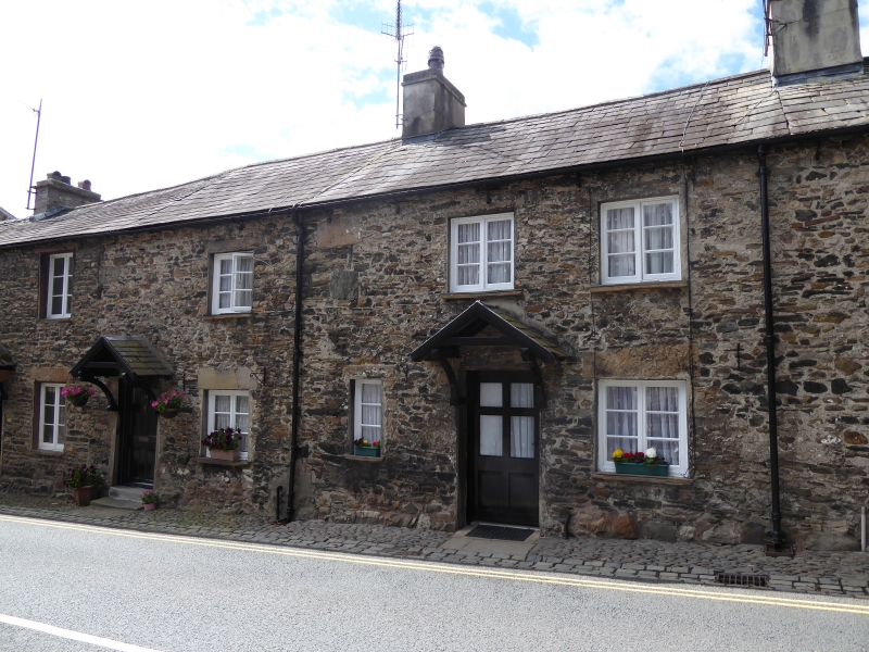
FAIRBANK
1.
5166 (south side)
Nos 14 and 16
SD 6078 NE 5/35
II GV
2.
Two mid C19 cottages. Two storeys. Rubble. Slate roof. One chimney. Casement
windows. Later C19 wooden gabled hoods over doors. Six panel doors.
Listing NGR: SD6098078866
External links are from the relevant listing authority and, where applicable, Wikidata. Wikidata IDs may be related buildings as well as this specific building. If you want to add or update a link, you will need to do so by editing the Wikidata entry.


Other nearby listed buildings
