Latitude: 54.2039 / 54°12'14"N
Longitude: -2.5993 / 2°35'57"W
OS Eastings: 361001
OS Northings: 478852
OS Grid: SD610788
Mapcode National: GBR BM9T.1R
Mapcode Global: WH94P.1LHK
Plus Code: 9C6V6C32+H7
Entry Name: 4 and 6, Fairbank
Listing Date: 22 March 1983
Grade: II
Source: Historic England
Source ID: 1318931
English Heritage Legacy ID: 75143
ID on this website: 101318931
Location: Kirkby Lonsdale, Westmorland and Furness, Cumbria, LA6
County: Cumbria
District: South Lakeland
Civil Parish: Kirkby Lonsdale
Built-Up Area: Kirkby Lonsdale
Traditional County: Westmorland
Lieutenancy Area (Ceremonial County): Cumbria
Church of England Parish: Kirkby Lonsdale Team Ministry
Church of England Diocese: Carlisle
Tagged with: Building
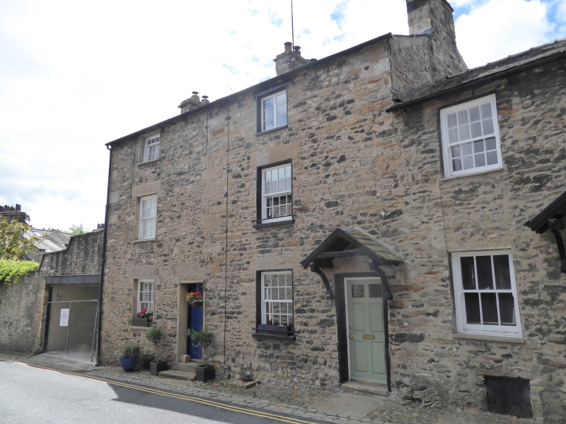
FAIRBANK
1.
5166 (south side)
Nos 4 and 6
SD 6078 NE 5/33
II GV
2.
Pair of late C18 or early C19 houses. Three storeys. Rubble. Slate roof. Three
chimneys. Quoins. Two windows to each house with plain reveals, sashed. Both doors
of six panels with upper four glazed. No 6 has hood on consoles.
Listing NGR: SD6100178852
External links are from the relevant listing authority and, where applicable, Wikidata. Wikidata IDs may be related buildings as well as this specific building. If you want to add or update a link, you will need to do so by editing the Wikidata entry.


Other nearby listed buildings