Latitude: 54.2026 / 54°12'9"N
Longitude: -2.5972 / 2°35'49"W
OS Eastings: 361141
OS Northings: 478707
OS Grid: SD611787
Mapcode National: GBR BM9V.J7
Mapcode Global: WH94P.2MJK
Plus Code: 9C6V6C33+34
Entry Name: 54 and 56, Main Street
Listing Date: 22 March 1983
Grade: II
Source: Historic England
Source ID: 1146364
English Heritage Legacy ID: 75178
ID on this website: 101146364
Location: Kirkby Lonsdale, Westmorland and Furness, Cumbria, LA6
County: Westmorland and Furness
District: South Lakeland
Civil Parish: Kirkby Lonsdale
Built-Up Area: Kirkby Lonsdale
Traditional County: Westmorland
Lieutenancy Area (Ceremonial County): Cumbria
Church of England Parish: Kirkby Lonsdale Team Ministry
Church of England Diocese: Carlisle
Tagged with: Building
MAIN STREET 1. 5166 (west side) Nos 54 and 56 SD 6178 NW 5/65 II GV
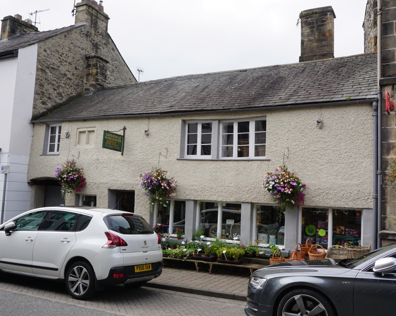
2. C17. Two storeys. Pebbledash over rubble. Slate roof. Two chimneys. Passage to yard left hand side. Ground floor has modern windows and doors. First floor has one small two light window with chamfered mullion (now blocked). The other windows with plain reveals and modern casements, that on right hand side with single unmoulded mullion. At rear a gabled wing runs back. On first floor this has two windows with wooden mullion and transom and leaded casements. Interior. Large segmental headed fireplace of circa 1600 with early C18 chimneypiece inside it, corbelled and with cornice. First floor has slotted lath partitions and collar roof. Formerly the Wheat sheaf Inn. (Annals).
Listing NGR: SD6114178707
External links are from the relevant listing authority and, where applicable, Wikidata. Wikidata IDs may be related buildings as well as this specific building. If you want to add or update a link, you will need to do so by editing the Wikidata entry.


Other nearby listed buildings