Approximate Location Map
Large Map »
Latitude: 51.8855 / 51°53'7"N
Longitude: -0.5274 / 0°31'38"W
OS Eastings: 501448
OS Northings: 221790
OS Grid: TL014217
Mapcode National: GBR G4Z.RH6
Mapcode Global: VHFRC.TV1Z
Plus Code: 9C3XVFPF+52
Entry Name: Windmill
Listing Date: 25 October 1951
Grade: II
Source: Historic England
Source ID: 1146443
English Heritage Legacy ID: 35771
ID on this website: 101146443
Location: Dunstable, Central Bedfordshire, LU6
County: Central Bedfordshire
Civil Parish: Dunstable
Built-Up Area: Dunstable
Traditional County: Bedfordshire
Lieutenancy Area (Ceremonial County): Bedfordshire
Church of England Parish: Dunstable
Church of England Diocese: St.Albans
Tagged with: Windmill
1.
5125 WEST STREET
(North Side)
Windmill
TL 012l 4/34 25.10.51.
II
2.
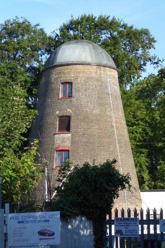
Brick sloping tower with domed cap. Late C18 or early C19. No sails. Single
storey additional buildings at back.
Listing NGR: TL0144821790
External links are from the relevant listing authority and, where applicable, Wikidata. Wikidata IDs may be related buildings as well as this specific building. If you want to add or update a link, you will need to do so by editing the Wikidata entry.


Other nearby listed buildings
