Approximate Location Map
Large Map »
Latitude: 51.916 / 51°54'57"N
Longitude: -0.6742 / 0°40'27"W
OS Eastings: 491283
OS Northings: 224996
OS Grid: SP912249
Mapcode National: GBR F32.Y2X
Mapcode Global: VHFR9.83FH
Plus Code: 9C3XW88G+C8
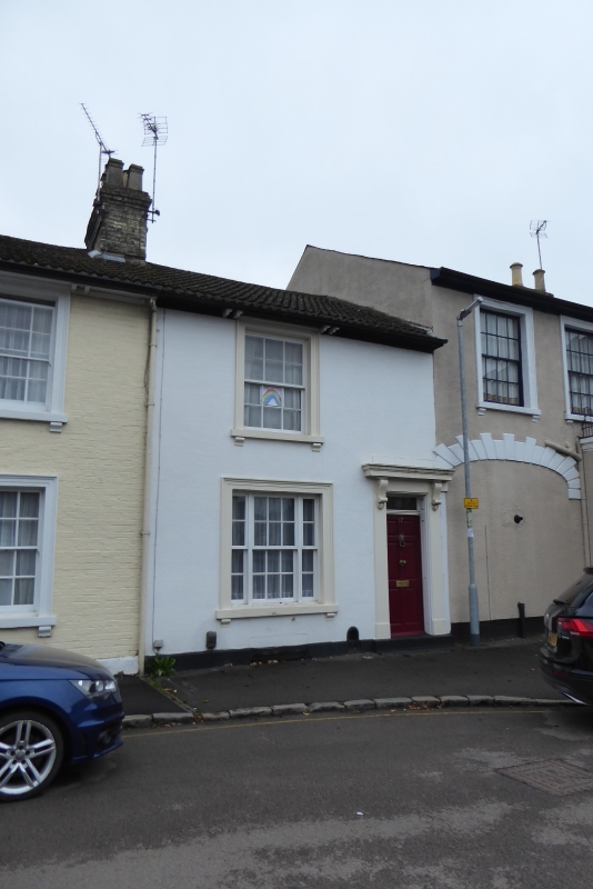
Entry Name: 17, Church Road
Listing Date: 1 May 1975
Grade: II
Source: Historic England
Source ID: 1146459
English Heritage Legacy ID: 35606
ID on this website: 101146459
Location: Linslade, Central Bedfordshire, LU7
County: Central Bedfordshire
Civil Parish: Leighton-Linslade
Built-Up Area: Leighton Buzzard
Traditional County: Buckinghamshire
Lieutenancy Area (Ceremonial County): Bedfordshire
Church of England Parish: Linslade
Church of England Diocese: St.Albans
Tagged with: Building
SP 9125 SW
5/244
SP 9124 NW
6/244
LINSLADE
CHURCH ROAD (South-West Side)
No 17
GV
II
Similar to No 15 but one window to each floor, both altered to casements.
Nos 13 to 21 (odd) form a group.
Listing NGR: SP9128324996
External links are from the relevant listing authority and, where applicable, Wikidata. Wikidata IDs may be related buildings as well as this specific building. If you want to add or update a link, you will need to do so by editing the Wikidata entry.


Other nearby listed buildings
