Latitude: 54.5874 / 54°35'14"N
Longitude: -3.3706 / 3°22'14"W
OS Eastings: 311527
OS Northings: 522218
OS Grid: NY115222
Mapcode National: GBR 4HXD.2B
Mapcode Global: WH703.6Y7M
Plus Code: 9C6RHJPH+XQ
Entry Name: Hudson Place Farmhouse
Listing Date: 5 September 1986
Grade: II
Source: Historic England
Source ID: 1146467
English Heritage Legacy ID: 72695
ID on this website: 101146467
Location: Cumberland, Cumbria, CA13
County: Cumberland
District: Allerdale
Civil Parish: Loweswater
Traditional County: Cumberland
Lieutenancy Area (Ceremonial County): Cumbria
Church of England Parish: Loweswater with Buttermere
Church of England Diocese: Carlisle
Tagged with: Farmhouse
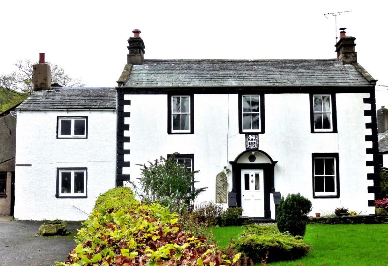
LOWESWATER LOWESWATER NY 12 SW 13/171 Hudson Place Farmhouse II Farmhouse. Dated on coat-of-arms 1741. Painted roughcast walls with eaves cornice and V-jointed quoins. Graduated greenslate roof with coped gables and kneelers; ashlar banded chimney stacks. 2 storeys, 3 bays, with lower single-bay, possibly earlier portion to left. C19 panelled door in painted stone architrave within stone porch which has low shaped side walls with pilasters supporting a segmental hood. Sash windows one with glazing bars, all in painted stone architraves. Lower portion has casement windows in original stone surrounds. Left C20 porch and rear barns are not of interest.
Listing NGR: NY1152722218
External links are from the relevant listing authority and, where applicable, Wikidata. Wikidata IDs may be related buildings as well as this specific building. If you want to add or update a link, you will need to do so by editing the Wikidata entry.


Other nearby listed buildings