Approximate Location Map
Large Map »
Latitude: 51.7239 / 51°43'25"N
Longitude: 0.8999 / 0°53'59"E
OS Eastings: 600382
OS Northings: 206776
OS Grid: TM003067
Mapcode National: GBR SQ3.SD5
Mapcode Global: VHKGR.KX2V
Plus Code: 9F32PVFX+HW
Entry Name: Stable to Rear, Approximately 10 Metres West of the Kings Head
Listing Date: 5 August 1986
Grade: II
Source: Historic England
Source ID: 1146967
English Heritage Legacy ID: 119221
ID on this website: 101146967
Location: Bradwell on Sea, Maldon, Essex, CM0
County: Essex
District: Maldon
Civil Parish: Bradwell-on-Sea
Traditional County: Essex
Lieutenancy Area (Ceremonial County): Essex
Church of England Parish: Bradwell-on-Sea St Thomas
Church of England Diocese: Chelmsford
Tagged with: Stable
TM 0006 BRADWELL-ON-SEA HIGH STREET
(west side)
10/44 Stable to rear,
approx. 10 metres
west of The Kings
Head
GV II
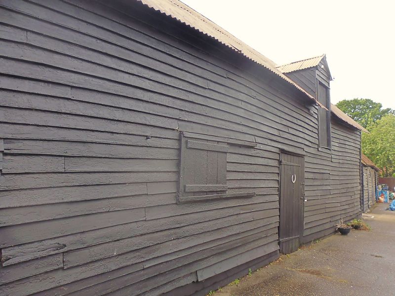
Stable with loft over and lower left range. C18/C19. Timber framed and
weatherboarded. Corrugated iron clad roof. Central gabled loft door.
Vertically boarded door. Original sliding shutters to left of door. Some
original ironmongery. Moulded grey brick floor with drain. Side purlin ridge
board roof, through bracing to walls.
Listing NGR: TM0038206776
External links are from the relevant listing authority and, where applicable, Wikidata. Wikidata IDs may be related buildings as well as this specific building. If you want to add or update a link, you will need to do so by editing the Wikidata entry.


Other nearby listed buildings
