Approximate Location Map
Large Map »
Latitude: 50.7914 / 50°47'28"N
Longitude: -3.9413 / 3°56'28"W
OS Eastings: 263265
OS Northings: 100886
OS Grid: SS632008
Mapcode National: GBR KW.ZKCD
Mapcode Global: FRA 27M0.4B9
Plus Code: 9C2RQ3R5+HF
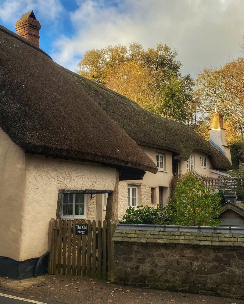
Entry Name: The Old Forge
Listing Date: 8 October 1987
Grade: II
Source: Historic England
Source ID: 1147171
English Heritage Legacy ID: 93068
ID on this website: 101147171
Location: Sampford Courtenay, West Devon, EX20
County: Devon
District: West Devon
Civil Parish: Sampford Courtenay
Traditional County: Devon
Lieutenancy Area (Ceremonial County): Devon
Church of England Parish: Sampford Courtenay St Andrew
Church of England Diocese: Exeter
Tagged with: Smithy Thatched cottage
SAMPFORD COURTENAY SAMPFORD COURTENAY
SS 60 SW
11/185 The Old Forge
GV II
House. Some medieval fabric probably considerably altered in C17 and extended in
C19 and C20. Plastered cob and rubble walls. Hipped thatch roof. 1 axial brick
stack.
Plan: original plan obscured by later alterations and additions but possibly of 2
rooms at the centre of the present building. At the left-hand end tile forge was
added possibly in the C17 judging from the evidence of a window. The building was
also extended in the C19 and C20 at the right-hand end.
Exterior: 2 storeys. Asymmetrical 2-window front to original part to left with
thatch roof extending in catslide over left-hand side supported on granite post
below. In the angle of the catslide and the main part of the house is a small 2-
light wooden mullion window with chamfered frame and diamond section mullion. C20
2-light casements. C20 plank door at right-hand end of old part. Immediately to
its left on ground floor is C15 2-lignt wooden mullion window with trefoiled heads
and carving in spandrels. The addition at the right-hand end of the house is
recessed with the end part of it projecting again slightly with mid-late C20
casements.
Interior inaccessible at time of survey.
Listing NGR: SS6326500886
External links are from the relevant listing authority and, where applicable, Wikidata. Wikidata IDs may be related buildings as well as this specific building. If you want to add or update a link, you will need to do so by editing the Wikidata entry.


Other nearby listed buildings
