Latitude: 51.6255 / 51°37'31"N
Longitude: 0.8163 / 0°48'58"E
OS Eastings: 595033
OS Northings: 195613
OS Grid: TQ950956
Mapcode National: GBR RQ0.35P
Mapcode Global: VHKH9.3DDQ
Plus Code: 9F32JRG8+6G
Entry Name: The Cabin Dairy
Listing Date: 27 January 1975
Grade: II
Source: Historic England
Source ID: 1147514
English Heritage Legacy ID: 116588
ID on this website: 101147514
Location: Burnham-on-Crouch, Maldon, Essex, CM0
County: Essex
District: Maldon
Civil Parish: Burnham-on-Crouch
Built-Up Area: Burnham-on-Crouch
Traditional County: Essex
Lieutenancy Area (Ceremonial County): Essex
Church of England Parish: Burnham-on-Crouch St Mary the Virgin
Church of England Diocese: Chelmsford
Tagged with: Architectural structure
1. HIGH STREET 5217 (South Side)
Nos 15, 17 and The Cabin Dairy TQ 9595 1/11
II GV
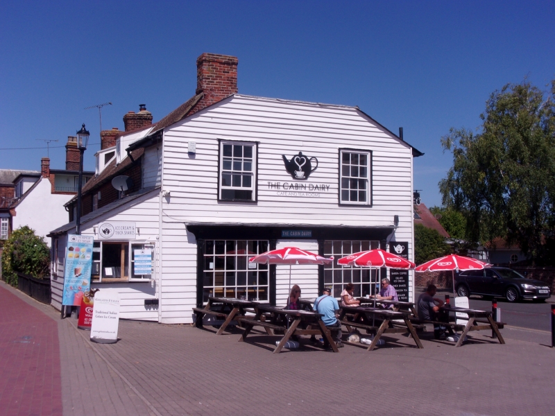
2. A range of C18 and early C19 buildings comprising a timber-framed and weatherboarded block at the east end and a red brick block adjoining on the west. The east block is 2 storeyed, with 2 window range on the east front, double-hung sashes with glazing bars. On the ground storey there are 2 C19 shop windows with glazing bars on the east front and a modern shop front on the north. Roof slate. The west block is 2 storeyed on the south front and 1 storey and attics on the north. The south front has 3 window range, double-hung sashes with glazing bars, in flush cased frames, 2 doorways, one with a "Tuscan" portico. Roofs tiled, with 2 sloping roofed dormers on the north side.
Nos 15, 17 and the Cabin Dairy form a group with Nos 14 to 18 (even).
Listing NGR: TQ9502695614
External links are from the relevant listing authority and, where applicable, Wikidata. Wikidata IDs may be related buildings as well as this specific building. If you want to add or update a link, you will need to do so by editing the Wikidata entry.


Other nearby listed buildings