Latitude: 51.6064 / 51°36'22"N
Longitude: 0.9226 / 0°55'21"E
OS Eastings: 602477
OS Northings: 193772
OS Grid: TR024937
Mapcode National: GBR SRP.62F
Mapcode Global: VHKHB.YW3F
Plus Code: 9F32JW4F+G3
Entry Name: Signal House
Listing Date: 29 October 1986
Grade: II
Source: Historic England
Source ID: 1147735
English Heritage Legacy ID: 123133
ID on this website: 101147735
Location: Courtsend, Rochford, Essex, SS3
County: Essex
District: Rochford
Civil Parish: Foulness
Traditional County: Essex
Lieutenancy Area (Ceremonial County): Essex
Tagged with: House
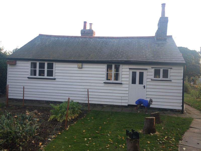
FOULNESS COURT END TR 09 SW 9/110 No. 41 Signal House 29.10.86 II Cottage. Circa 1800. Timber framed and weatherboarded. Grey slate roof. Left ridge and forward off centre right gault brick chimney stacks, that to right plastered. Single storey. 2 windows, to left a 2-light casement with glazing bars, to right a small paned vertically sliding sash. There are 2 doors, each with 2 vertical upper lights, one to right the other between the windows. Pentice boards over. The frame appears to be intact with a side purlin ridge board roof. There are 6 rooms. The 2 chimney stacks have back to back fireplaces, one with a C19 cast iron grate and surround. Original dining room cupboard. A line of 28 coastal signal stations from North Foreland to Lands End was established by the Admiraltry in 1794, the line was extended to Great Yarmouth the following year and subsequently on to cover most of the coastline. A signal house is shown in the position of this building on the Map of Foulness by J. Grist 1801. There were 2 signal houses on Foulness, the other at Burwood was demolished late C19. In 1811 the Officer (Lieutenant) in occupation of this house was John Lundin. The equipment comprised a 50 foot mast with a 30 foot top mast and 30 foot crossyard from which could be displayed from 10 hoists, one red flag, one blue pendant and 4 black balls, which could be arranged through 145 combinations, each of which was related to an arbitrary signal. The signal stations were closed in 1815 at the end of the War. This is one of the very few survivors, one other presumed station is at Bradwell-on-Sea. R.W. Crump. Foulness Archaeological Society, The First lO Years, 1975-85. October 1985, unpublished May 1986.
Listing NGR: TR0247793772
External links are from the relevant listing authority and, where applicable, Wikidata. Wikidata IDs may be related buildings as well as this specific building. If you want to add or update a link, you will need to do so by editing the Wikidata entry.


Other nearby listed buildings