Latitude: 50.4363 / 50°26'10"N
Longitude: -3.8391 / 3°50'20"W
OS Eastings: 269492
OS Northings: 61219
OS Grid: SX694612
Mapcode National: GBR QC.FX4Y
Mapcode Global: FRA 27VW.VKP
Plus Code: 9C2RC5P6+G9
Entry Name: Lutton House
Listing Date: 27 May 1986
Grade: II
Source: Historic England
Source ID: 1147861
English Heritage Legacy ID: 99368
ID on this website: 101147861
Location: Lutton, South Hams, Devon, TQ10
County: Devon
District: South Hams
Civil Parish: South Brent
Traditional County: Devon
Lieutenancy Area (Ceremonial County): Devon
Church of England Parish: South Brent St Petroc
Church of England Diocese: Exeter
Tagged with: House
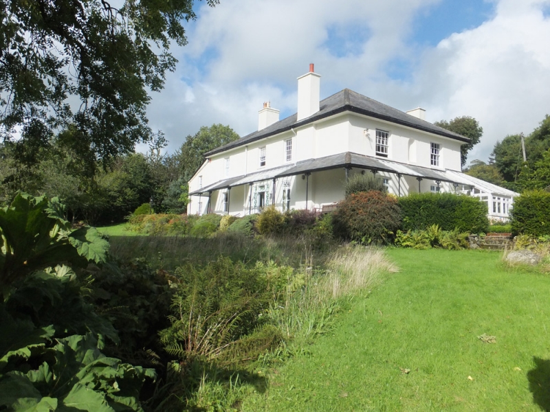
SOUTH BRENT LUTTON
SX 66 SE
5/88 Lutton House
-
- II
House. Circa 1830-40 with later C19 rear extension to north. Stuccoed stone.
Slate hipped roof with deep eaves. Double depth plan. Two storeys. Three bay
south front. Round-headed niche at centre on both floors. First floor sashes
with glazing bars, ground floor French windows. Verandah on ground floor with
ornate iron brackets.
Listing NGR: SX6949261219
External links are from the relevant listing authority and, where applicable, Wikidata. Wikidata IDs may be related buildings as well as this specific building. If you want to add or update a link, you will need to do so by editing the Wikidata entry.


Other nearby listed buildings