Approximate Location Map
Large Map »
Latitude: 54.4867 / 54°29'12"N
Longitude: -0.612 / 0°36'43"W
OS Eastings: 490017
OS Northings: 511041
OS Grid: NZ900110
Mapcode National: GBR SJ5K.9D
Mapcode Global: WHG9Y.KHS7
Plus Code: 9C6XF9PQ+M6
Entry Name: The Clinic
Listing Date: 4 December 1972
Grade: II
Source: Historic England
Source ID: 1148247
English Heritage Legacy ID: 326800
ID on this website: 101148247
Location: Whitby, North Yorkshire, YO22
County: North Yorkshire
District: Scarborough
Civil Parish: Whitby
Built-Up Area: Whitby
Traditional County: Yorkshire
Lieutenancy Area (Ceremonial County): North Yorkshire
Church of England Parish: Whitby St Mary
Church of England Diocese: York
Tagged with: Architectural structure
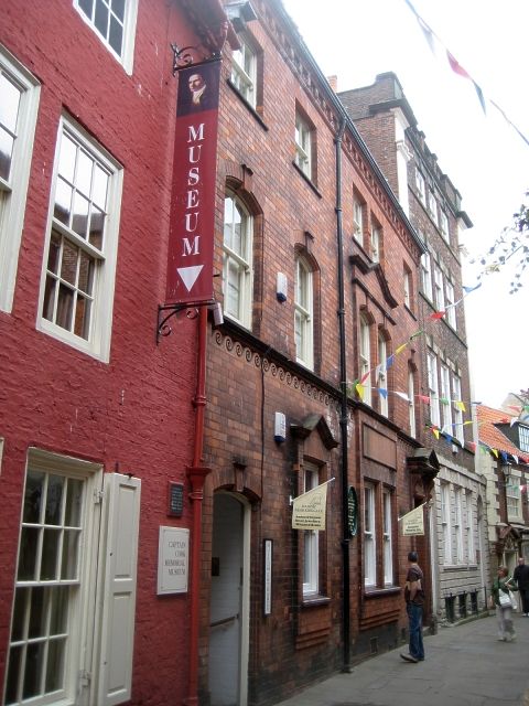
1811 GRAPE LANE
(South Side)
The Clinic
NZ 9011 2/136
II GV
2.
Much altered C18 house, refronted in brick in late Cl9. Interior has 2
good enriched panelled rooms with original mantelpieces. lst floor room
has very fine C18 pierced steel grate with obelisks and urns.
Captain Cook's House, the Clinic and Nos 19 to 28 (consec) form a group.
Listing NGR: NZ9001711041
External links are from the relevant listing authority and, where applicable, Wikidata. Wikidata IDs may be related buildings as well as this specific building. If you want to add or update a link, you will need to do so by editing the Wikidata entry.


Other nearby listed buildings
