Approximate Location Map
Large Map »
Latitude: 54.486 / 54°29'9"N
Longitude: -0.6145 / 0°36'52"W
OS Eastings: 489854
OS Northings: 510958
OS Grid: NZ898109
Mapcode National: GBR SJ4K.RN
Mapcode Global: WHG9Y.JHLS
Plus Code: 9C6XF9PP+C5
Entry Name: 17, Baxtergate
Listing Date: 4 December 1972
Grade: II
Source: Historic England
Source ID: 1148385
English Heritage Legacy ID: 326536
ID on this website: 101148385
Location: Whitby, North Yorkshire, YO21
County: North Yorkshire
District: Scarborough
Civil Parish: Whitby
Built-Up Area: Whitby
Traditional County: Yorkshire
Lieutenancy Area (Ceremonial County): North Yorkshire
Church of England Parish: Whitby St Mary
Church of England Diocese: York
Tagged with: Building
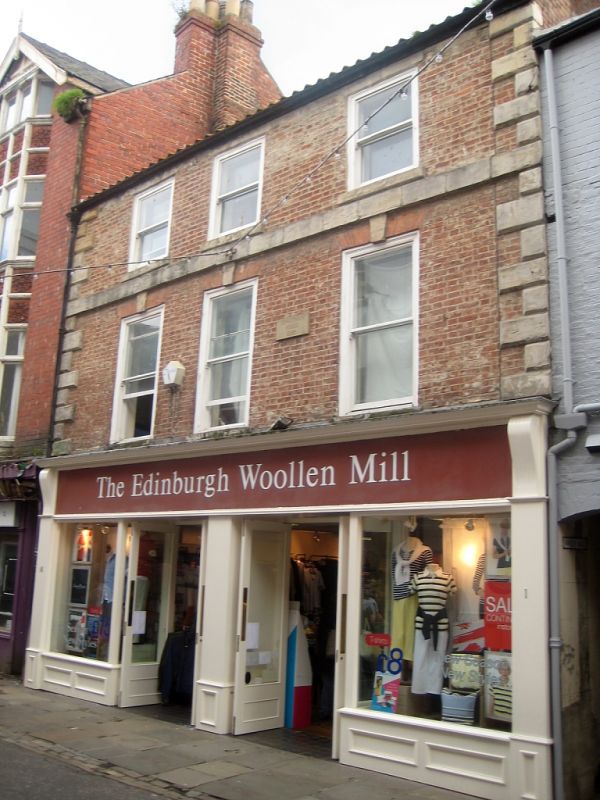
1.
l811 BAXTERGATE
(South Side)
No 17
NZ 8910 3/252
II
2.
Cl8. 3 storeys in painted brick. Pantile roof. Stone rusticated quoins.
Stone band between 2nd and 3rd floors, 3 windows, flat brick arch with
keystone, flush frames, double-hung sashes, no glazing bars, Modern shop
front. Included for group value only.
Listing NGR: NZ8985410958
External links are from the relevant listing authority and, where applicable, Wikidata. Wikidata IDs may be related buildings as well as this specific building. If you want to add or update a link, you will need to do so by editing the Wikidata entry.


Other nearby listed buildings
