Latitude: 54.4473 / 54°26'50"N
Longitude: -0.9279 / 0°55'40"W
OS Eastings: 469618
OS Northings: 506290
OS Grid: NZ696062
Mapcode National: GBR PKY0.XK
Mapcode Global: WHF8V.QHB0
Plus Code: 9C6XC3WC+WR
Entry Name: Prudom headstone and stone to north, 0.5 metres, south of St. Hilda's church tower
Listing Date: 20 December 1990
Grade: II
Source: Historic England
Source ID: 1148594
English Heritage Legacy ID: 327944
ID on this website: 101148594
Location: St Hilda's Church, North Yorkshire, YO21
County: North Yorkshire
District: Scarborough
Civil Parish: Danby
Traditional County: Yorkshire
Lieutenancy Area (Ceremonial County): North Yorkshire
Church of England Parish: Danby with Castleton and Commondale
Church of England Diocese: York
Tagged with: Tombstone
This list entry was subject to a Minor Amendment on 18 June 2025 to reformat the text to current standards
NZ 60 NE
6/26
DANBY
DANBY DALE (east side)
Prudom headstone and stone to north, 0.5m, south of St. Hilda's church tower
GV
lI
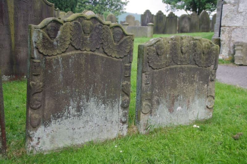
Two headstones, side by side. 1775 and 177?. Each has a shaped top with three primitive angels whose wings are shaped like broad ruffled collars. Borders, with symbols of mortality, frame inscribed central panels, the left one to Thomas Prudom d.1775, the right indecipherable but almost exactly similar.
Listing NGR: NZ6961806290
External links are from the relevant listing authority and, where applicable, Wikidata. Wikidata IDs may be related buildings as well as this specific building. If you want to add or update a link, you will need to do so by editing the Wikidata entry.


Other nearby listed buildings