Latitude: 54.4474 / 54°26'50"N
Longitude: -0.9279 / 0°55'40"W
OS Eastings: 469619
OS Northings: 506309
OS Grid: NZ696063
Mapcode National: GBR PKY0.XH
Mapcode Global: WHF8V.QGBW
Plus Code: 9C6XC3WC+XR
Entry Name: Church of St Hilda
Listing Date: 6 October 1969
Grade: II*
Source: Historic England
Source ID: 1316255
English Heritage Legacy ID: 327939
Also known as: St Hilda's Church, Danby Dale, North Yorkshire
ID on this website: 101316255
Location: St Hilda's Church, North Yorkshire, YO21
County: North Yorkshire
District: Scarborough
Civil Parish: Danby
Traditional County: Yorkshire
Lieutenancy Area (Ceremonial County): North Yorkshire
Church of England Parish: Danby with Castleton and Commondale
Church of England Diocese: York
Tagged with: Church building
NZ 60 NE DANBY DANBY DALE East side
6/21 Church of St. Hilda 6.10.69
GV II*
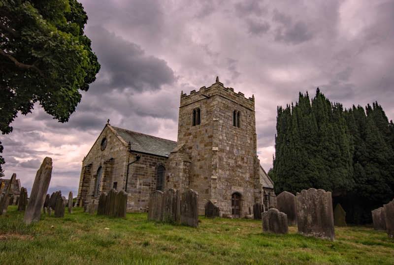
Church. C14 tower-porch. Nave rebuilt 1789, chancel added 1848 possibly by Butterfield; restoration by Temple Moore in 1903. Sandstone, the tower large square blocks, nave finely-coursed tooled blocks, chancel ashlar. Graduated Lakeland slate roof with ridged stone copings, finials and gable crosses. Aisled nave with south porch/tower, chancel with short north vestry. West end has 2 stout buttresses flanking large round-headed window with triple keystone and impost blocks; oculus above; small square-headed aisle end windows. At north-west corner external stair to gallery added 1808 (dated on plaque inside window). Plinth around nave; tall keyed round-arched aisle windows. South tower of one tall stage with diagonal buttresses, eaves string with prominent waterspouts to east and west and battlemented parapet with corner pinnacles. Short extruded west vice with tiny window. Hollow-chamfered, segment-headed doorway. Single tiny light above and paired bell openings with cusped heads. Chancel in Early English style with narrow lancets to north and south and 3-light east window with plate tracery head. Pent vestry under continuous roof. Asymmetrical: vestry and east end each have one straight and one diagonal stepped buttress.
Interior plastered. 4-bay nave. Very tall double-chamfered pointed arcade on round piers, rebuilt by Temple Moore but leaving most of one capital to show the reconstruction was correct. C19 king-post nave roof and arch-braced chancel roof. Panelled west gallery. Minton tiles in chancel and raised sanctuary. In porch and inside door boards giving names of subscribers to the school and benefactors of the parish from C17 to early C19. Medieval grave cover in porch.
Pevsner, N. Riding p. 135.
Listing NGR: NZ6961906309
External links are from the relevant listing authority and, where applicable, Wikidata. Wikidata IDs may be related buildings as well as this specific building. If you want to add or update a link, you will need to do so by editing the Wikidata entry.


Other nearby listed buildings