Approximate Location Map
Large Map »
Latitude: 54.5387 / 54°32'19"N
Longitude: -0.7738 / 0°46'25"W
OS Eastings: 479432
OS Northings: 516629
OS Grid: NZ794166
Mapcode National: GBR RH1Y.8S
Mapcode Global: WHF8K.25SW
Plus Code: 9C6XG6QG+FF
Entry Name: Thornhill
Listing Date: 10 December 1985
Grade: II
Source: Historic England
Source ID: 1148922
English Heritage Legacy ID: 327209
ID on this website: 101148922
Location: Hinderwell, North Yorkshire, TS13
County: North Yorkshire
District: Scarborough
Civil Parish: Hinderwell
Built-Up Area: Hinderwell
Traditional County: Yorkshire
Lieutenancy Area (Ceremonial County): North Yorkshire
Church of England Parish: Hinderwell with Roxby and Staithes
Church of England Diocese: York
Tagged with: Building
NZ 7916 HINDERWELL HIGH STREET
(east side)
9/134
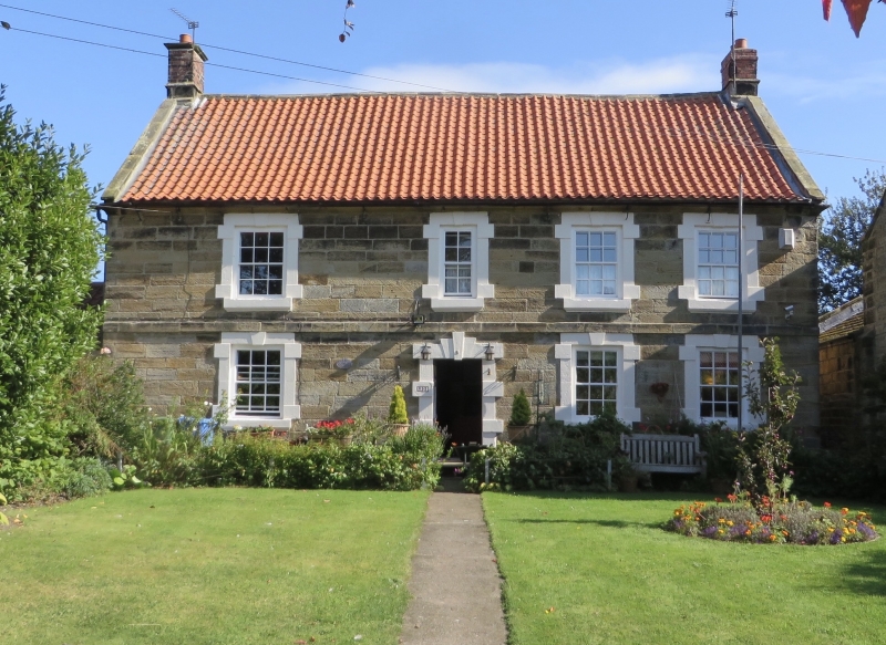
- No 95(Thornhill)
- II
House, C18. Coursed squared stone with first floor band. Swept pantiled roof
with stone copings and brick end chimneys. Two storeys, 4 windows, sashes with
glazing bars in alternating-block surrounds with keystones. 6-panel door in similar
surround.
Listing NGR: NZ7943216629
External links are from the relevant listing authority and, where applicable, Wikidata. Wikidata IDs may be related buildings as well as this specific building. If you want to add or update a link, you will need to do so by editing the Wikidata entry.


Other nearby listed buildings
