Latitude: 54.5582 / 54°33'29"N
Longitude: -0.7903 / 0°47'24"W
OS Eastings: 478331
OS Northings: 518775
OS Grid: NZ783187
Mapcode National: GBR QHXQ.QT
Mapcode Global: WHF8B.TPWH
Plus Code: 9C6XH655+7V
Entry Name: Church of St Peter the Fisherman, and attached clergy house
Listing Date: 26 March 1973
Last Amended: 10 December 1985
Grade: II
Source: Historic England
Source ID: 1148944
English Heritage Legacy ID: 327159
Also known as: St Peter the Fisherman's Church, Staithes
ID on this website: 101148944
Location: Staithes, North Yorkshire, TS13
County: North Yorkshire
District: Scarborough
Civil Parish: Hinderwell
Built-Up Area: Staithes
Traditional County: Yorkshire
Lieutenancy Area (Ceremonial County): North Yorkshire
Church of England Parish: Hinderwell with Roxby and Staithes
Church of England Diocese: York
Tagged with: Church building
This list entry was subject to a Minor Amendment on 7 October 2025 to correct a typo in the description and to reformat the text to current standards
NZ 7818 NW
8/84
HINDERWELL
Staithes
CHURCH STREET (west side)
Church of St Peter the Fisherman, and attached clergy house
(Formerly listed as Mission Church to St Peter the Fisherman)
26.3.73
II
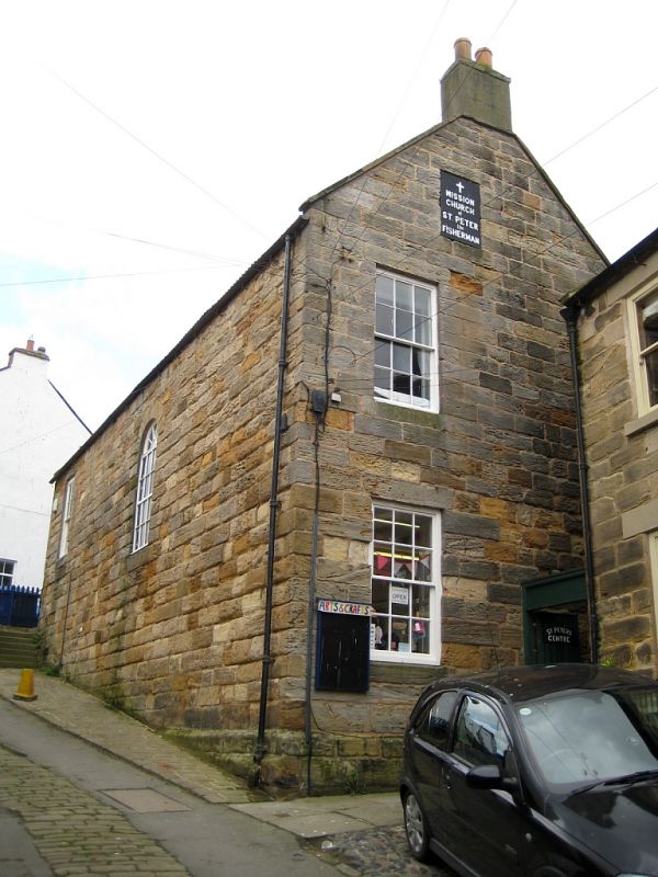
Mission Church. Mid C19. Originally a school. Coursed stone with shallow plinth. Roof, renewed in asbestos pantiles, has stone copings and single chimney. One tall storey and undercroft. One blocked round-arched window and a modern window inserted. Undercroft has four original sashes with glazing bars and shutters intact and a six panel door. Porch, with pantiled roof, bellcote and chimney, at south-west corner links to clergy house which has a six-panel door and two sash windows with glazing bars.
Listing NGR: NZ7833118775
External links are from the relevant listing authority and, where applicable, Wikidata. Wikidata IDs may be related buildings as well as this specific building. If you want to add or update a link, you will need to do so by editing the Wikidata entry.


Other nearby listed buildings