Approximate Location Map
Large Map »
Latitude: 54.4664 / 54°27'59"N
Longitude: -0.6745 / 0°40'28"W
OS Eastings: 486007
OS Northings: 508702
OS Grid: NZ860087
Mapcode National: GBR RJQS.RP
Mapcode Global: WHG9X.MZ0V
Plus Code: 9C6XF88G+H5
Entry Name: Bridge to South of Pond House
Listing Date: 6 October 1969
Last Amended: 10 December 1985
Grade: II
Source: Historic England
Source ID: 1148957
English Heritage Legacy ID: 327092
ID on this website: 101148957
Location: Aislaby, North Yorkshire, YO21
County: North Yorkshire
District: Scarborough
Civil Parish: Aislaby
Traditional County: Yorkshire
Lieutenancy Area (Ceremonial County): North Yorkshire
Church of England Parish: Aislaby St Margaret
Church of England Diocese: York
Tagged with: Bridge
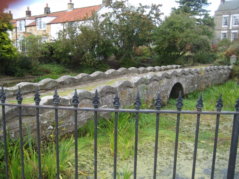
NZ 8608 AISLABY MAIN ROAD
(north side)
17/17
Bridge to south of
Pond House (formerly
6.10.69 listed as Bridge at
Pond House)
GV II
Bridge over small beck. Early C19. Stone. Single round arch and wavy parapets.
Approached by stone causeway.
Listing NGR: NZ8600708702
External links are from the relevant listing authority and, where applicable, Wikidata. Wikidata IDs may be related buildings as well as this specific building. If you want to add or update a link, you will need to do so by editing the Wikidata entry.


Other nearby listed buildings
