Approximate Location Map
Large Map »
Latitude: 54.4664 / 54°27'59"N
Longitude: -0.6748 / 0°40'29"W
OS Eastings: 485991
OS Northings: 508702
OS Grid: NZ859087
Mapcode National: GBR RJQS.QP
Mapcode Global: WHG9X.LZWV
Plus Code: 9C6XF88G+H3
Entry Name: 36, Main Road
Listing Date: 6 October 1969
Last Amended: 10 December 1985
Grade: II
Source: Historic England
Source ID: 1178632
English Heritage Legacy ID: 327093
ID on this website: 101178632
Location: Aislaby, North Yorkshire, YO21
County: North Yorkshire
District: Scarborough
Civil Parish: Aislaby
Traditional County: Yorkshire
Lieutenancy Area (Ceremonial County): North Yorkshire
Church of England Parish: Aislaby St Margaret
Church of England Diocese: York
Tagged with: Building
NZ 8508
16/18
6.1.69
AISLABY
MAIN ROAD
(north side)
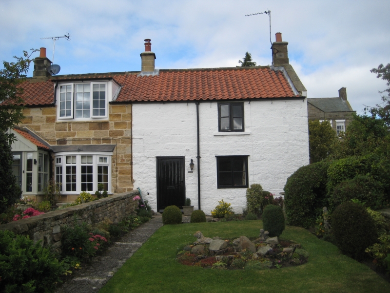
No 36 (formerly listed as part of White Row)
GV
II
Cottage, end of a terrace, C18. Coursed squared stone, whitewashed. Pantiled
roof with stone copings and square kneelers, end stone chimneys. 2 storeys,
1 window, C19 one-bar casements. Boarded door.
Listing NGR: NZ8599108702
External links are from the relevant listing authority and, where applicable, Wikidata. Wikidata IDs may be related buildings as well as this specific building. If you want to add or update a link, you will need to do so by editing the Wikidata entry.


Other nearby listed buildings
