Approximate Location Map
Large Map »
Latitude: 54.1204 / 54°7'13"N
Longitude: -0.9083 / 0°54'30"W
OS Eastings: 471448
OS Northings: 469945
OS Grid: SE714699
Mapcode National: GBR QN3S.4P
Mapcode Global: WHFBF.0PQL
Plus Code: 9C6X43CR+5M
Entry Name: Walled Garden Sundial Pedestal
Listing Date: 22 June 1987
Grade: II
Source: Historic England
Source ID: 1148985
English Heritage Legacy ID: 329043
ID on this website: 101148985
Location: North Yorkshire, YO60
County: North Yorkshire
District: Ryedale
Civil Parish: Henderskelfe
Traditional County: Yorkshire
Lieutenancy Area (Ceremonial County): North Yorkshire
Church of England Parish: Bulmer St Martin
Church of England Diocese: York
Tagged with: Walled garden
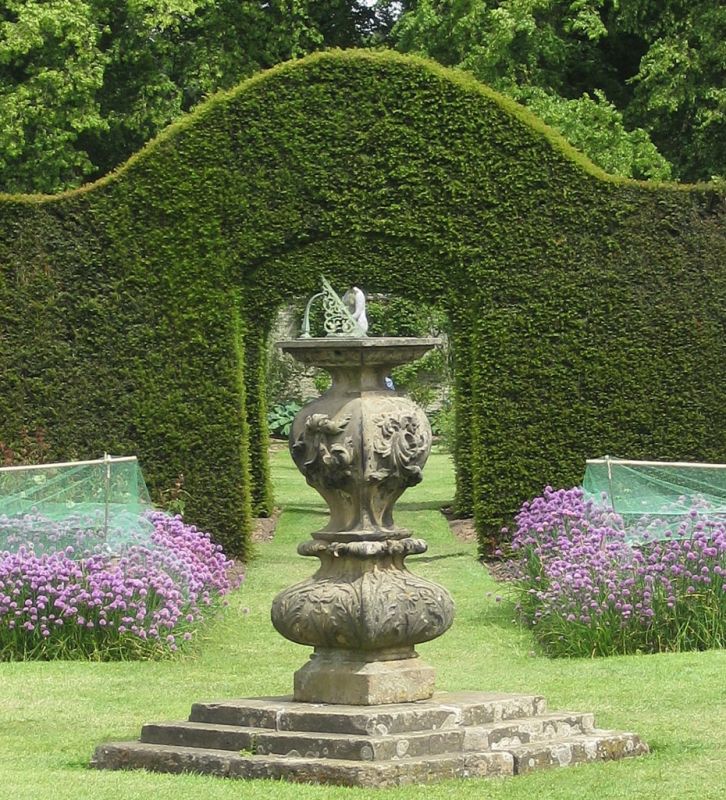
HENDERSKELFE WALLED GARDEN
SE 7169
Castle Howard
12/87 Sundial and pedestal
GV II
Sundial and pedestal on which it stands. Mid C18 sundial with later
pedestal. Bronze sundial on stone pedestal. Approximately one metre in
height. Lobed pedestal with foliate enrichment. Incised sundial with
delicately-wrought gnomon.
Listing NGR: SE7144869945
External links are from the relevant listing authority and, where applicable, Wikidata. Wikidata IDs may be related buildings as well as this specific building. If you want to add or update a link, you will need to do so by editing the Wikidata entry.


Other nearby listed buildings
