Latitude: 54.1187 / 54°7'7"N
Longitude: -0.8941 / 0°53'38"W
OS Eastings: 472380
OS Northings: 469763
OS Grid: SE723697
Mapcode National: GBR QN6T.6B
Mapcode Global: WHFBF.7QGY
Plus Code: 9C6X4494+F8
Entry Name: New River the New River Bridge
Listing Date: 25 January 1954
Grade: I
Source: Historic England
Source ID: 1149011
English Heritage Legacy ID: 329002
ID on this website: 101149011
Location: North Yorkshire, YO60
County: North Yorkshire
District: Ryedale
Civil Parish: Henderskelfe
Traditional County: Yorkshire
Lieutenancy Area (Ceremonial County): North Yorkshire
Church of England Parish: Bulmer St Martin
Church of England Diocese: York
Tagged with: Bridge
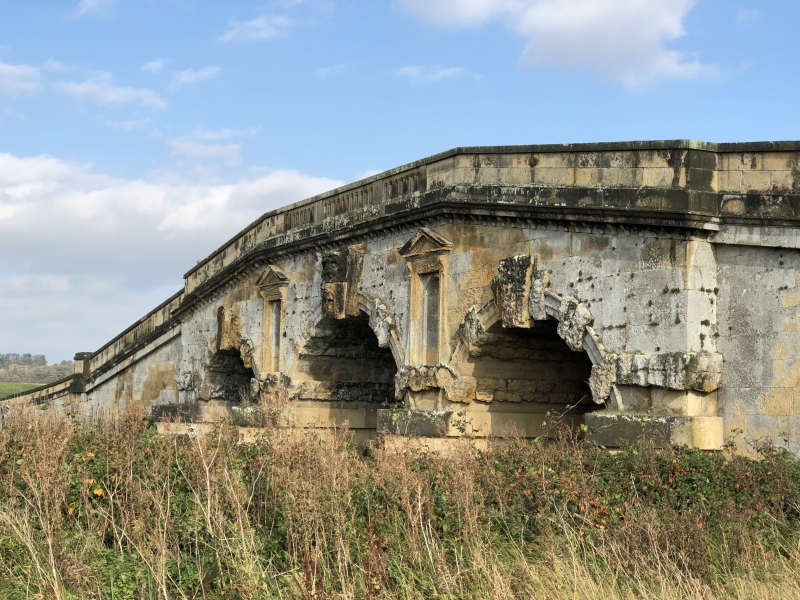
HENDERSKELFE NEW RIVER SE 76 NW Castle Howard 7/46 The New River Bridge 25.1.54 GV I Bridge. c1740. By Daniel Garrett for Henry, 4th Earl of Carlisle. Sandstone ashlar. Banded rustication to cutwaters dividing 3 stepped segmental arches each with rusticated voussoirs and a mask keystone to central arch. Niches in tooled architraves with pulvinated friezes and consoles supporting pediments flank the main arch. Brackets support cornice surmounted by low parapet with central balustrade and coping. Ramped approaches have balustrading, rusticated piers to centre, and square-section end piers. Hussey C, English Gardens and Landscapes 1700-1750, 1967. HBMC, Register of Parks and Gardens of special historic interest in England, Part 32, North Yorkshire: Castle Howard, Grade I.
Listing NGR: SE7238269766
External links are from the relevant listing authority and, where applicable, Wikidata. Wikidata IDs may be related buildings as well as this specific building. If you want to add or update a link, you will need to do so by editing the Wikidata entry.


Other nearby listed buildings