Latitude: 54.3051 / 54°18'18"N
Longitude: -0.8839 / 0°53'2"W
OS Eastings: 472722
OS Northings: 490514
OS Grid: SE727905
Mapcode National: GBR QL8N.FJ
Mapcode Global: WHF9N.D1BZ
Plus Code: 9C6X8448+2C
Entry Name: Vicarage
Listing Date: 24 June 1987
Grade: II
Source: Historic England
Source ID: 1149024
English Heritage Legacy ID: 328933
ID on this website: 101149024
Location: Lastingham, North Yorkshire, YO62
County: North Yorkshire
District: Ryedale
Civil Parish: Lastingham
Traditional County: Yorkshire
Lieutenancy Area (Ceremonial County): North Yorkshire
Church of England Parish: Lastingham St Mary
Church of England Diocese: York
Tagged with: Clergy house
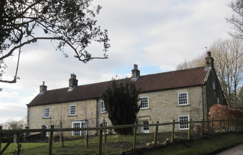
LASTINGHAM ANSERDALE LANE SE 7290 (west side, off) 12/96 Vicarage - II Vicarage. 1777; partly rebuilt 1829; extended to rear and altered mid C19 and C20. 1829 rebuilding by Rev Robert Harrison. Dressed sandstone to front and right gable wall; coursed rubble sandstone to rear and left gable end; herringbone-tooled quoins and vertically tooled sills and lintels. Timber porch. Pantile roof. 2-storey, 5-window front. Gabled porch to centre right over Tudor-arched, hollow chamfered quoined doorway with flat hoodmould. Nail-studded door half-glazed over recessed panels enclosing quatrefoils. Door lintel inscribed: "RH 1829". C20 inserted French door to end left. Centre left window is a canted bay with small-pane sashes. First-floor centre window is mullioned, of 2 shouldered lights with diamond panes, beneath flat hoodmould. Remaining windows are 16-pane sashes with wedge lintels and stone sills. Coped gables and plain kneelers. End and centre left and right stacks. Rear: quoined, single-storey outshut raised to left to provide a cross-gabled staircase window. Window is mullioned, of 2 shouldered lights with diamond panes, plain stone sill and lintel.
Listing NGR: SE7272290514
External links are from the relevant listing authority and, where applicable, Wikidata. Wikidata IDs may be related buildings as well as this specific building. If you want to add or update a link, you will need to do so by editing the Wikidata entry.


Other nearby listed buildings