Latitude: 54.0996 / 54°5'58"N
Longitude: -0.8316 / 0°49'53"W
OS Eastings: 476503
OS Northings: 467706
OS Grid: SE765677
Mapcode National: GBR QPM1.R5
Mapcode Global: WHFBN.6781
Plus Code: 9C6X35X9+R9
Entry Name: Suspension Bridge Across River Derwent
Listing Date: 11 February 1987
Grade: II
Source: Historic England
Source ID: 1149115
English Heritage Legacy ID: 328743
ID on this website: 101149115
Location: Menethorpe, North Yorkshire, YO60
County: North Yorkshire
District: Ryedale
Town: Ryedale
Civil Parish: Burythorpe
Traditional County: Yorkshire
Lieutenancy Area (Ceremonial County): North Yorkshire
Church of England Parish: West Buckrose
Church of England Diocese: York
Tagged with: Bridge
SE 76 NE
2/39
BURYTHORPE
MENETHORPE LANE
(west side, off)
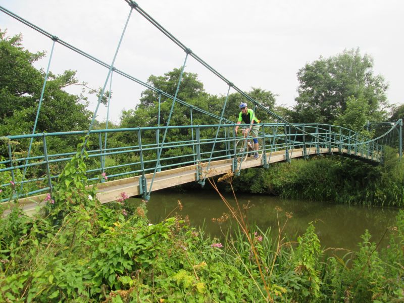
Suspension Bridge across River Derwent
II
Footbridge. Mid - late C19. Wrought iron and steel with wooden walkway.
Piers supporting round arches with steel cables supporting walkway with
handrail.
Listing NGR: SE7650367706
External links are from the relevant listing authority and, where applicable, Wikidata. Wikidata IDs may be related buildings as well as this specific building. If you want to add or update a link, you will need to do so by editing the Wikidata entry.


Other nearby listed buildings