Latitude: 54.0996 / 54°5'58"N
Longitude: -0.8316 / 0°49'53"W
OS Eastings: 476500
OS Northings: 467706
OS Grid: SE765677
Mapcode National: GBR QPM1.R5
Mapcode Global: WHFBN.6771
Plus Code: 9C6X35X9+R8
Entry Name: Suspension Bridge Across River Derwent
Listing Date: 25 April 1986
Grade: II
Source: Historic England
Source ID: 1173501
English Heritage Legacy ID: 329701
ID on this website: 101173501
Location: Menethorpe, North Yorkshire, YO60
County: North Yorkshire
District: Ryedale
Town: Ryedale
Civil Parish: Burythorpe
Traditional County: Yorkshire
Lieutenancy Area (Ceremonial County): North Yorkshire
Church of England Parish: West Buckrose
Church of England Diocese: York
SE 76 NE
6/19
HUTTONS AMBO
WATER LANE
Low Hutton
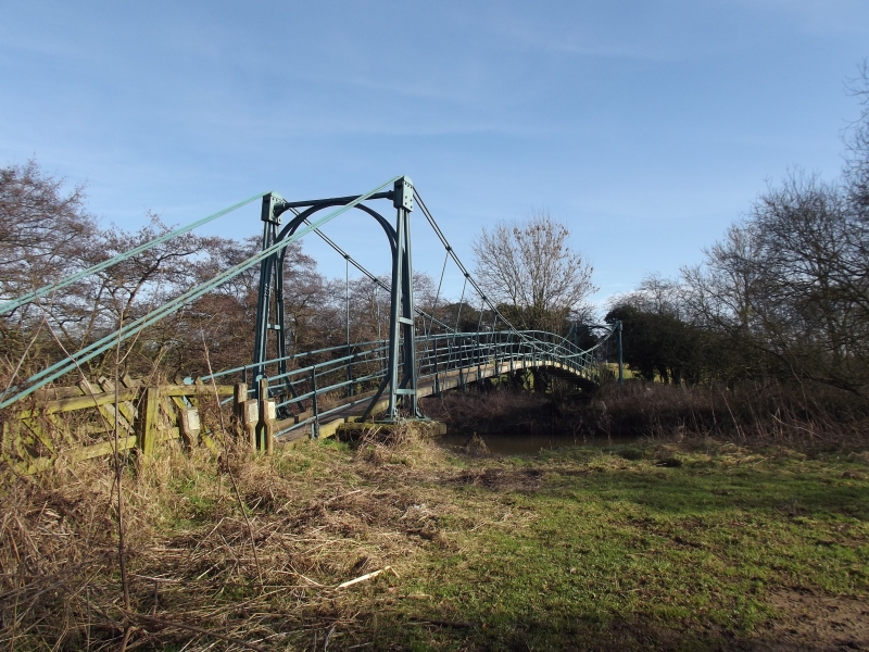
Suspension bridge across River Derwent
GV
II
Footbridge. Late C19. Cast-iron railway metals with steel cable; brick
piers with stone caps; plank walkway. Single-span suspension bridge. Piers
support A-frame pylons linked at each end by round arches; cables support
walkway with handrail.
Listing NGR: SE7650067706


Other nearby listed buildings