Latitude: 54.3539 / 54°21'14"N
Longitude: -0.8875 / 0°53'15"W
OS Eastings: 472401
OS Northings: 495944
OS Grid: SE724959
Mapcode National: GBR QL73.N0
Mapcode Global: WHF98.BTML
Plus Code: 9C6X9436+HX
Entry Name: Chest Tomb Approximately 11 Metres to North East of the Church of St Mary and St Laurence
Listing Date: 27 August 1987
Grade: II
Source: Historic England
Source ID: 1149726
English Heritage Legacy ID: 382467
ID on this website: 101149726
Location: Rosedale Abbey, North Yorkshire, YO18
County: North Yorkshire
District: Ryedale
Civil Parish: Rosedale East Side
Traditional County: Yorkshire
Lieutenancy Area (Ceremonial County): North Yorkshire
Tagged with: Chest tomb
SE 7295
16/49
ROSEDALE EAST SIDE
ROSEDALE ABBEY
Chest tomb approximately 11 metres to north-east of the Church of St Mary and St Laurence
GV
II
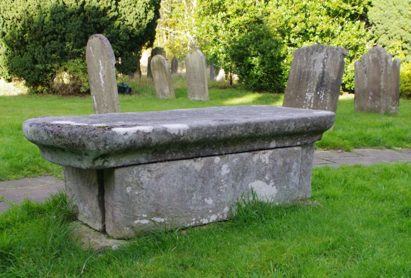
Chest tomb. Probably early C18. No inscriptions visible. Plain chest
constructed of single stone slabs. Flat, overhanging cover, curved at one
end and with bevelled corners at the other end.
Listing NGR: SE7240195944
External links are from the relevant listing authority and, where applicable, Wikidata. Wikidata IDs may be related buildings as well as this specific building. If you want to add or update a link, you will need to do so by editing the Wikidata entry.


Other nearby listed buildings