Latitude: 54.4601 / 54°27'36"N
Longitude: -1.3206 / 1°19'14"W
OS Eastings: 444139
OS Northings: 507398
OS Grid: NZ441073
Mapcode National: GBR MJ6V.WZ
Mapcode Global: WHD7J.P5B5
Plus Code: 9C6WFM6H+2Q
Entry Name: Town End Farmhouse
Listing Date: 4 August 1983
Grade: II
Source: Historic England
Source ID: 1150267
English Heritage Legacy ID: 331892
ID on this website: 101150267
Location: Crathorne, North Yorkshire, TS15
County: North Yorkshire
District: Hambleton
Civil Parish: Crathorne
Traditional County: Yorkshire
Lieutenancy Area (Ceremonial County): North Yorkshire
Church of England Parish: Crathorne All Saints
Church of England Diocese: York
Tagged with: Farmhouse
NZ 4407
9/9
CRATHORNE
HUTTON RUDBY ROAD
(south-east side)
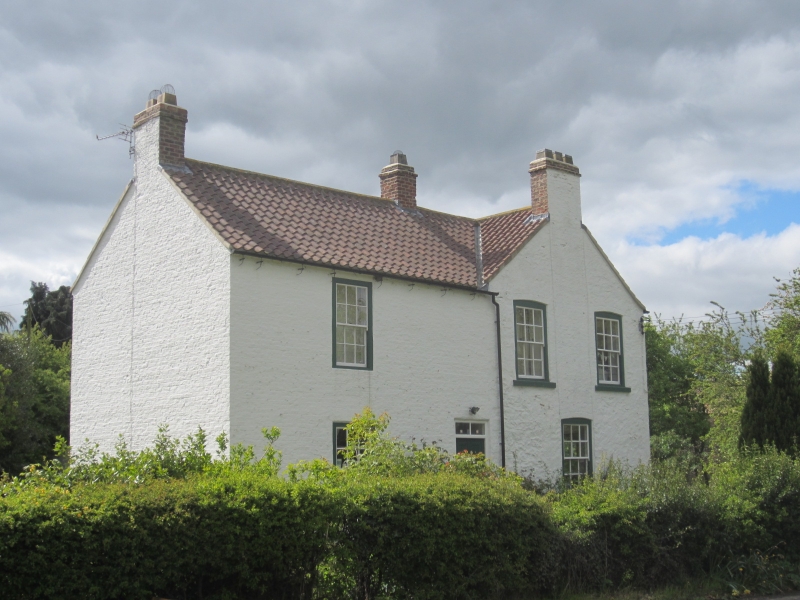
Town End Farmhouse
II
Early C19. Rendered brick. L-shaped. Pantiled roof with brick end chimneys. Two
storeys, two windows, sashes with glazing bars. Central door and another door in East
wing. Long, one-storey south wing of similar materials.
Listing NGR: NZ4413907398
External links are from the relevant listing authority and, where applicable, Wikidata. Wikidata IDs may be related buildings as well as this specific building. If you want to add or update a link, you will need to do so by editing the Wikidata entry.


Other nearby listed buildings