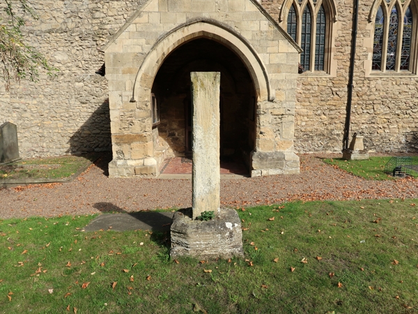
Latitude: 53.5658 / 53°33'56"N
Longitude: -1.2686 / 1°16'7"W
OS Eastings: 448537
OS Northings: 407936
OS Grid: SE485079
Mapcode National: GBR MWL6.4H
Mapcode Global: WHDCT.HM3R
Plus Code: 9C5WHP8J+8H
Entry Name: Crossbase with Shaft, Situated Immediately to South of Porch to Church of All Saints
Listing Date: 11 April 1986
Grade: II
Source: Historic England
Source ID: 1151625
English Heritage Legacy ID: 334515
ID on this website: 101151625
Location: All Saints' Church, Hooton Pagnell, Doncaster, South Yorkshire, DN5
County: Doncaster
Civil Parish: Hooton Pagnell
Traditional County: Yorkshire
Lieutenancy Area (Ceremonial County): South Yorkshire
Church of England Parish: Bilham
Church of England Diocese: Sheffield
SE4807 HOOTON PAGNELL
11/94 Crossbase with shaft, situated immediately to south of porch to Church of All Saints
GV II
Crossbase with shaft. Late medieval base, later shaft. Limestone. Base has stop-chamfered corners. Square shaft with lightly-chamfered corners with stops. Formerly used as a sundial pedestal, dial and gnomon now missing.
Listing NGR: SE4853707936


Other nearby listed buildings