Latitude: 53.3829 / 53°22'58"N
Longitude: -1.3025 / 1°18'9"W
OS Eastings: 446491
OS Northings: 387562
OS Grid: SK464875
Mapcode National: GBR MYBB.T1
Mapcode Global: WHDDR.Y7XG
Plus Code: 9C5W9MMW+4X
Entry Name: 23, Main Street
Listing Date: 1 April 1987
Grade: II
Source: Historic England
Source ID: 1151848
English Heritage Legacy ID: 336004
ID on this website: 101151848
Location: Ulley, Rotherham, South Yorkshire, S26
County: Rotherham
Civil Parish: Ulley
Traditional County: Yorkshire
Lieutenancy Area (Ceremonial County): South Yorkshire
Church of England Parish: Ulley Holy Trinity
Church of England Diocese: Sheffield
Tagged with: Building
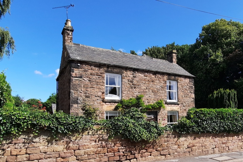
ULLEY MAIN STREET SK48NE (north side) 6/129 No 23 II Farmhouse. Mid C18 partly rebuilt mid C19. Coursed, squared sandstone, Welsh slate roof, C19 work in rock-faced sandstone. L-shaped plan with wing to rear-right and additions in the angle. C18 facade on right return of wing: 2 storeys, 4 windows to 1st floor. Large quoins. Door in moulded ashlar surround flanked on right by two 2-light square-faced mullioned windows with 4-pane casements and on left by a similar window, continuous lintel band; single-light window in gable end of front range is double- chamfered and has dripstone. 1st floor of wing: 4 windows as ground floor, lintel band. Brick end stack on right, stone gable-end stack to front range on left. Roadside front: door with overlight flanked by margin-light-glazed sashes with projecting sills and rock-faced lintels, matching end stack on left. Interior: rear wing has contemporary staircase with turned balusters and square newels.
Listing NGR: SK4649187562
External links are from the relevant listing authority and, where applicable, Wikidata. Wikidata IDs may be related buildings as well as this specific building. If you want to add or update a link, you will need to do so by editing the Wikidata entry.


Other nearby listed buildings