Latitude: 50.6084 / 50°36'30"N
Longitude: -1.9588 / 1°57'31"W
OS Eastings: 403008
OS Northings: 78742
OS Grid: SZ030787
Mapcode National: GBR 459.PLL
Mapcode Global: FRA 67SG.GP3
Plus Code: 9C2WJ25R+9F
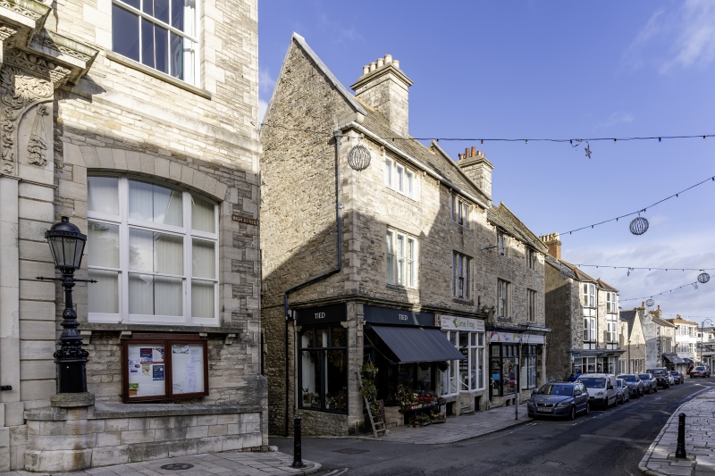
Entry Name: 56, 58, 60 and 62, High Street
Listing Date: 21 March 1983
Grade: II
Source: Historic England
Source ID: 1152403
English Heritage Legacy ID: 108185
ID on this website: 101152403
Location: Swanage, Dorset, BH19
County: Dorset
Civil Parish: Swanage
Built-Up Area: Swanage
Traditional County: Dorset
Lieutenancy Area (Ceremonial County): Dorset
Church of England Parish: Swanage St Mary the Virgin
Church of England Diocese: Salisbury
Tagged with: Building
1.
5190
SZ 0378 NW
5/59
HIGH STREET
(north side)
Nos 56, 58, 60 and 62
II
GV
2.
1877. Architect: G.Rickmay. Purbeck Stone walls and roof. Stone stacks with
moulded caps. A 3-storey terrace of shops, with basements. Ground floor has C19
and C20 shop fronts framed by Corinthian pilasters and moulded stone cornices.
A shield, probably originally with Coat of Arms, between Nos 58 and 60. On the first
floor each building has a 3-light stone mullioned window with leaded lights under a
store relieving arch. Similar windows to the second floor. Group value with the
Town Hall. The capitals and shield fmom Castle Mondolfo in Italy.
Listing NGR: SZ0300878742
External links are from the relevant listing authority and, where applicable, Wikidata. Wikidata IDs may be related buildings as well as this specific building. If you want to add or update a link, you will need to do so by editing the Wikidata entry.


Other nearby listed buildings