Approximate Location Map
Large Map »
Latitude: 54.9723 / 54°58'20"N
Longitude: -2.0125 / 2°0'45"W
OS Eastings: 399296
OS Northings: 564187
OS Grid: NY992641
Mapcode National: GBR GBDY.2C
Mapcode Global: WHB2F.19Y0
Plus Code: 9C6VXXCP+WX
Entry Name: Spout Well
Listing Date: 24 May 1988
Grade: II
Source: Historic England
Source ID: 1154752
English Heritage Legacy ID: 239875
ID on this website: 101154752
Location: Corbridge, Northumberland, NE45
County: Northumberland
Civil Parish: Corbridge
Built-Up Area: Corbridge
Traditional County: Northumberland
Lieutenancy Area (Ceremonial County): Northumberland
Church of England Parish: Corbridge with Halton and Newton Hall
Church of England Diocese: Newcastle
Tagged with: Well
CORBRIDGE B 6530(South side,off)
NY 9964 Corbridge
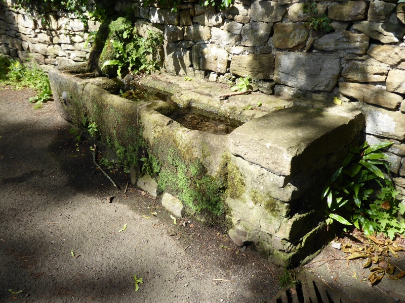
22/114 Spout Well
II
Spring and troughs, probably C18. Stone, cast iron. Spring emerges through
stone spout in drystone wall and falls into triple stone trough; first trough
has bucket rest bars and old iron spout.
Listing NGR: NY9929664187
External links are from the relevant listing authority and, where applicable, Wikidata. Wikidata IDs may be related buildings as well as this specific building. If you want to add or update a link, you will need to do so by editing the Wikidata entry.


Other nearby listed buildings
