Approximate Location Map
Large Map »
Latitude: 51.4513 / 51°27'4"N
Longitude: -0.9684 / 0°58'6"W
OS Eastings: 471778
OS Northings: 172985
OS Grid: SU717729
Mapcode National: GBR QMH.K5
Mapcode Global: VHDWT.5SD9
Plus Code: 9C3XF22J+GJ
Entry Name: 7 and 9, Church Street
Listing Date: 5 October 1977
Grade: II
Source: Historic England
Source ID: 1155056
English Heritage Legacy ID: 38874
ID on this website: 101155056
Location: Reading, Berkshire, RG1
County: Reading
Electoral Ward/Division: Katesgrove
Parish: Non Civil Parish
Built-Up Area: Reading
Traditional County: Berkshire
Lieutenancy Area (Ceremonial County): Berkshire
Church of England Parish: Reading St Giles
Church of England Diocese: Oxford
Tagged with: Building
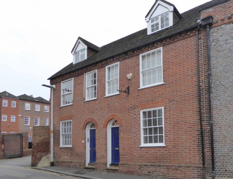
CHURCH STREET
1.
5128
(South Side)
Nos 7 and 9
SU 7172 NE 4/450 5.10.77.
II GV
2.
Early C19. 2 storeys, attic and cellar. Red brick on plinth. Brick block
eaves course. Tiled roof with one dormer. 4 windows on 1st floor, glazing
bar sashes with moulded surrounds. Ground floor windows blocked. 2 central
round headed doorways, plain fanlights, 6 panel doors.
Listing NGR: SU7177872985
External links are from the relevant listing authority and, where applicable, Wikidata. Wikidata IDs may be related buildings as well as this specific building. If you want to add or update a link, you will need to do so by editing the Wikidata entry.


Other nearby listed buildings
