Latitude: 51.4513 / 51°27'4"N
Longitude: -0.9685 / 0°58'6"W
OS Eastings: 471769
OS Northings: 172982
OS Grid: SU717729
Mapcode National: GBR QMH.J6
Mapcode Global: VHDWT.5SB9
Plus Code: 9C3XF22J+GH
Entry Name: 11, Church Street
Listing Date: 5 October 1977
Grade: II
Source: Historic England
Source ID: 1321936
English Heritage Legacy ID: 38875
ID on this website: 101321936
Location: Reading, Berkshire, RG1
County: Reading
Electoral Ward/Division: Katesgrove
Parish: Non Civil Parish
Built-Up Area: Reading
Traditional County: Berkshire
Lieutenancy Area (Ceremonial County): Berkshire
Church of England Parish: Reading St Giles
Church of England Diocese: Oxford
Tagged with: Building
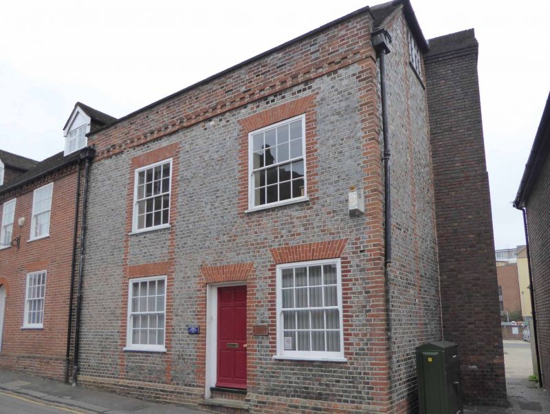
CHURCH STREET
1.
5128
(South Side)
No 11
SU 7172 NE 4/451 5.10.77.
II GV
2.
Late C18. 2 1/2 storeys. Grey brick headers with red brick dressings and quoins.
Plinth. Brick dentil cornice. Parapet. Mansard tile roof, hipped to right.
2 ranges of glazing bar sash windows with slightly cambered heads, blocked
on ground floor. Central 6 panel door.
Listing NGR: SU7176972982
External links are from the relevant listing authority and, where applicable, Wikidata. Wikidata IDs may be related buildings as well as this specific building. If you want to add or update a link, you will need to do so by editing the Wikidata entry.


Other nearby listed buildings