Latitude: 51.7601 / 51°45'36"N
Longitude: -1.8424 / 1°50'32"W
OS Eastings: 410973
OS Northings: 206831
OS Grid: SP109068
Mapcode National: GBR 3QJ.P04
Mapcode Global: VHB2M.01V2
Plus Code: 9C3WQ565+22
Entry Name: Barn Approximately 50 Metres North West of Arlington Farmhouse
Listing Date: 23 January 1952
Last Amended: 5 February 1987
Grade: II
Source: Historic England
Source ID: 1155189
English Heritage Legacy ID: 127301
ID on this website: 101155189
Location: Arlington, Cotswold, Gloucestershire, GL7
County: Gloucestershire
District: Cotswold
Civil Parish: Bibury
Built-Up Area: Arlington
Traditional County: Gloucestershire
Lieutenancy Area (Ceremonial County): Gloucestershire
Church of England Parish: Bibury with Winson
Church of England Diocese: Gloucester
Tagged with: Barn
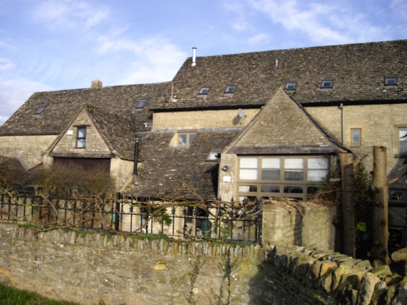
BIBURY ARLINGTON SP 1006-1106 11/55 Barn approximately. 50m north west of Arlington Farmhouse 23.1.52 (previously listed with Arlington Farmhouse) GV II Barn. Late C18; early C19 addition. Random rubble limestone; stone slate roof. Five-bay barn with 4-bay addition to north west. Attached outbuildings to south east end, now converted to house, are not of special interest. South west side: central gabled porch to earlier part to right with timber lintel and plank barn doors. Outshut to left with lean-to roof and low plank door with timber lintel. Similar porch to barn extension to left with gabled outbuilding beyond having concrete tile roof. North east side: gabled porch to barn as to south west side; doorway with timber lintel and plank door to barn extension to right; loft doorway to right. Interiors of barn not inspected but probably collar and tie-beam truss roof.
Listing NGR: SP1097306831
External links are from the relevant listing authority and, where applicable, Wikidata. Wikidata IDs may be related buildings as well as this specific building. If you want to add or update a link, you will need to do so by editing the Wikidata entry.


Other nearby listed buildings