Latitude: 51.8084 / 51°48'30"N
Longitude: -2.1458 / 2°8'44"W
OS Eastings: 390042
OS Northings: 212209
OS Grid: SO900122
Mapcode National: GBR 1LW.J9V
Mapcode Global: VH94L.RTG1
Plus Code: 9C3VRV53+9M
Entry Name: Barn and Cattle Shed Approximately 150 Metres North East of Old Overtown House
Listing Date: 28 September 1984
Last Amended: 24 March 1987
Grade: II
Source: Historic England
Source ID: 1156181
English Heritage Legacy ID: 132714
ID on this website: 101156181
Location: Cranham, Stroud, Gloucestershire, GL4
County: Gloucestershire
District: Stroud
Civil Parish: Cranham
Traditional County: Gloucestershire
Lieutenancy Area (Ceremonial County): Gloucestershire
Church of England Parish: Cranham St James the Great
Church of England Diocese: Gloucester
Tagged with: Barn
SO 91 SW at CRANHAM OVERTOWN NGR SO 900122
2/155 Barn and cattle shed approximately 150m north east of Old Overtown 28.9.84 House (previously listed as Overtowr Barn and Cattleshed)
II
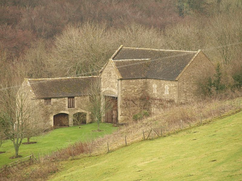
Barn and cattle shed. Dated I.D. 1846 for Rev John Davies. Coursed rubble limestone with ashlar dressings; concrete tile and asbestos slate roofs. Seven-bay barn with east and west porches; five-bay cattle shed with loft to west forms L-plan. Parapet gabled central west barn porch with dated keystone to segmental arch above timber lintel to doorway with plank doors. Lean-to porch on east side. Three slit vents either side of porch to main barn wall, each with cast-iron grille. Pitching holes to loft on. east side. Parapet gabled barn ends with slit vents. South-facing cattle shed has 2 wide low segmental arched openings, central loft doorway and 2 smaller flanking pitching holes. Two-light ovolo moulded ground floor casement to gabled west end of cattle shed, single-light above, both probably reused. Interior: part of barn has inserted loft. Seven-bay tie-beam truss roof with bolted collars; two rows of purlins. Loft of cattle shed partially plastered. Five-bay collar truss roof with single row of purlins. Two unequal rooms below for loose yard cattle. Impressive position on slope. A fine example of mid C19 ultilitarian farm buildings.
Listing NGR: SO9004212209
External links are from the relevant listing authority and, where applicable, Wikidata. Wikidata IDs may be related buildings as well as this specific building. If you want to add or update a link, you will need to do so by editing the Wikidata entry.


Other nearby listed buildings