Approximate Location Map
Large Map »
Latitude: 53.4425 / 53°26'32"N
Longitude: -0.8405 / 0°50'25"W
OS Eastings: 477117
OS Northings: 394593
OS Grid: SK771945
Mapcode National: GBR QXKM.VP
Mapcode Global: WHFFR.2Q1S
Plus Code: 9C5XC5R5+XR
Entry Name: Swallow Bridge, Chesterfield Canal
Listing Date: 23 November 1984
Grade: II
Source: Historic England
Source ID: 1156723
English Heritage Legacy ID: 241157
ID on this website: 101156723
Location: Misterton, Bassetlaw, Nottinghamshire, DN10
County: Nottinghamshire
District: Bassetlaw
Civil Parish: Misterton
Built-Up Area: Misterton
Traditional County: Nottinghamshire
Lieutenancy Area (Ceremonial County): Nottinghamshire
Church of England Parish: Misterton
Church of England Diocese: Southwell and Nottingham
Tagged with: Bridge Architectural structure
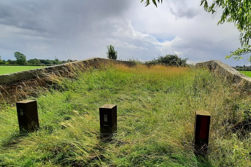
SK 79 SE MISTERTON
6/96 Swallow Bridge,
Chesterfield
Canal.
II
Canal bridge, c.1776, brick with stone coping. Single stilted
segmental arch with curved parapet walls with stone. Chamfered
stone coping. 4 squared brick piers with square stone caps.
Listing NGR: SK7711794593
External links are from the relevant listing authority and, where applicable, Wikidata. Wikidata IDs may be related buildings as well as this specific building. If you want to add or update a link, you will need to do so by editing the Wikidata entry.


Other nearby listed buildings
